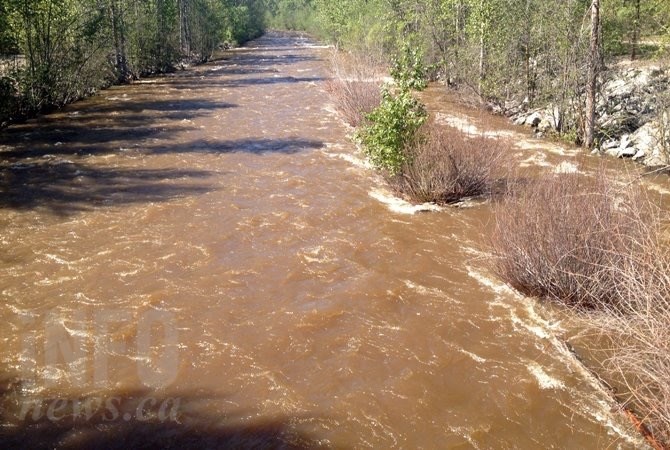
Heavy June rains pushed up the flow rates in Kelowna's Mission Creek and the Thompson River.
(ADAM PROSKIW / iNFOnews.ca)
June 21, 2022 - 12:34 PM
So far this month, 63.9 millimetres of rain have fallen on the Kelowna Airport.
That’s the wettest June recorded on the Environment Canada online website that goes back to 2014.
That’s not as wet as Vernon where 76.9 mm were recorded. Kamloops came in at 24.8 mm with Penticton at 43.5 mm.
In most cases that’s almost double the wettest June recorded back to 2014.
Heat this weekend should bring flood relief to lakeshore residents in the Okanagan.
“Mission Creek is very vulnerable to rain events,” Shaun Reimer, section head, public safety and protection for the Ministry of Forests, told iNFOnews.ca today, June 21. “Every day, it becomes a little less vulnerable.”
The situation is different for Kamloops where flood watch warnings for the North and South Thompson Rivers were issued on the weekend. Persistent heavy rain is expected in the upper elevation watersheds of both those rivers over the next few days.
READ MORE: Cool damp week to turn sunny, hot in Kamloops, Okanagan by weekend
The worst may be over for Okanagan Lake.
“We see every day the lake rise decreases,” Reimer said. “We’re getting to the point in the year when our inflows start dropping off, other than when we get hit with these rain events that have been a little more significant than forecast even a day or two in advance.”
The lake is 11 centimetres above what is considered full pool but 14 cm below what it was at this time last year.
The level of Okanagan Lake rose two centimetres yesterday but it went up three centimetres the day before so inflows may soon equal outflows.
Reimer is in charge of controlling the flow of water out of Okanagan Lake into the Okanagan River channel at the dam in Penticton.
Earlier this year, he was dealing with a lower than average snowpack following an extremely dry 2021 so there was concern about getting enough water into the lake.
Things were looking good until a couple of weeks ago when heavy rains hit the upper Mission Creek watershed where an automated weather station recorded 65 mm of rain overnight.
“That’s really big,” Reimer said. “No wonder it drove such a big peak. At the time, we thought the weather system was going to be more focused on the Kootenays. It’s a bit of a testament to how unpredictable a lot of the weather patterns have been, particularly this June.”
The amount of water he’s releasing from Okanagan Lake is beyond the designed maximum for the river channel. That means low lying areas downstream are seeing pooling from groundwater and Vaseux Lake is rising.
The good news for the Okanagan is that not much rain is forecast for this week so the upper elevation snowpack should continue to melt slowly.
This will be followed by a high pressure system hitting the area on the weekend with temperatures expected to reach into the low 30 Celsius range.
That may be bad news for Kamloops residents as the Thompson River snowpacks were 245% to 254% above normal as of June 15.
READ MORE: Flood watch issued for South Thompson River
To contact a reporter for this story, email Rob Munro or call 250-808-0143 or email the editor. You can also submit photos, videos or news tips to the newsroom and be entered to win a monthly prize draw.
We welcome your comments and opinions on our stories but play nice. We won't censor or delete comments unless they contain off-topic statements or links, unnecessary vulgarity, false facts, spam or obviously fake profiles. If you have any concerns about what you see in comments, email the editor in the link above.
News from © iNFOnews, 2022