
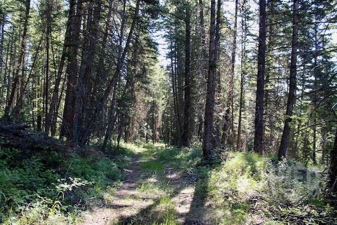
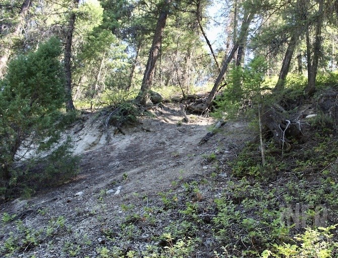
This is the start to the lower part of the High Rim Trail, running from below the Philpott Road-Highway 33 intersection down to Mission Creek.
(ROB MUNRO / iNFOnews.ca)
July 02, 2021 - 7:30 AM
The war in the woods has raged for decades in B.C. but is taking a different twist in the Joe Rich area east of Kelowna.
With logging moving closer into the populated area of the Joe Rich neighbourhood, residents are pushing back. They’re calling for a moratorium on all logging in the area until studies are done on the impact of logging on water quality and slope stability. They handed out brochures at strategic points last weekend.
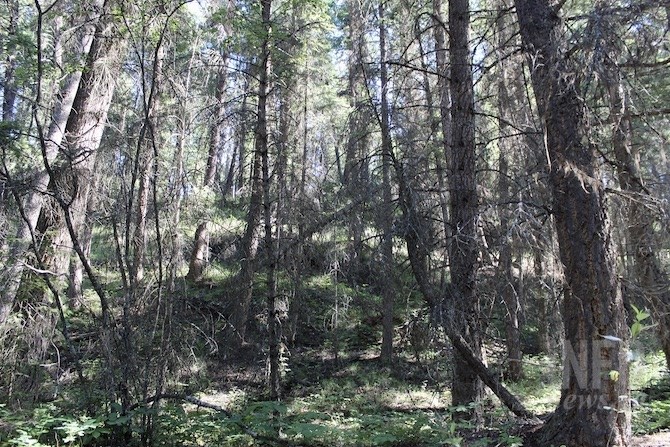
One particular forest is at the centre of their concerns.
“The parcel of land directly south of Philpott Road — scheduled to be logged this fall — should be set aside as a Regional District of Central Okanagan nature reserve," one of their posters states. “This land is the base of the High Rim Trail and should be protected for its natural beauty and recreational value, not cut down for commercial profit.”
Some have described it as an old growth forest but it was logged many years ago, probably in the 1940s or 1950s, resident Reg Volk said. Trees from the Joe Rich area provided timbers for the Myra Canyon trestles.
An old logging road makes for a gentle but longer walk down to the creek than taking the trail.
(ROB MUNRO / iNFOnews.ca)
“It’s like a watershed forest,” Louise Abbott, treasurer of the Joe Rich Ratepayers and Tenants Society told iNFOnews.ca. “It’s very different from our typical Okanagan landscape as far as forests go. It’s mossy with ferns and beautiful cedars, quite pristine and very natural. Lots of people call it a magical place. It’s been undisturbed for a very long time. It’s a unique area for the Okanagan.”
That’s not the way Randy Hardy, planning forester with Gorman Bros. Lumber Ltd., sees it.
“In my mind, it is a nice trail that goes down from the highway to Mission Creek itself,” he said. “What we’re trying to prevent is what happened on the other side of the highway.”
The other side of the highway was burned during the Philpott Road forest fire in 2017 and has since been clearcut in order to take out marketable timber and remove dangerous trees.
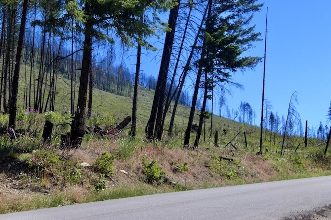
The 2017 Philpott Road fire led to this hillside above the road being clearcut. Gorman Bros. Lumber wants to avoid a fire doing the same below the highway.
(ROB MUNRO / iNFOnews.ca)
That’s the point where the High Rim trail, which actually starts at Mission Creek, climbs up to the height of land through to Cosens Bay on the north end of Kalamalka Lake.
That trail was built in the 1980s or 1990s by the Western Canada Wilderness Committee.
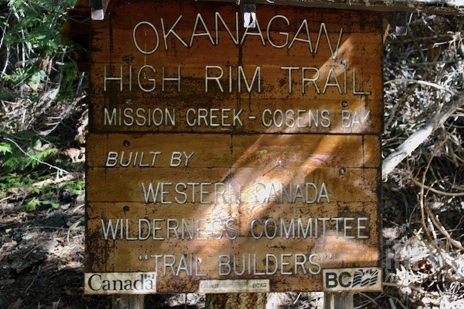
This is the sign down by Mission Creek, marking the start of the High Rim Trail that runs to Cosens Bay at the north end of Kalamalka Lake.
(ROB MUNRO / iNFOnews.ca)
So, while Joe Rich residents are concerned about a number of logging sites in their area, this trail has become a focal point.
The reality is that Gorman Bros. Lumber doesn’t want to go in there strictly for “commercial profit," although the timber obviously has value to them.
They also want to thin the forest, similar to what was done on June Springs Road in 2019, to reduce the risk of wildfire.
READ MORE: Logging on Kelowna’s South Slopes will create park-like setting and ward off wildfires
There’s an old logging road that allows for a more gradual, two-kilometre walk down to Mission Creek than the actual High Rim Trail.
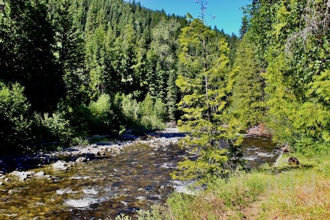
Mission Creek at the start to the High Rim Trail
(ROB MUNRO / iNFOnews.ca)
Across the creek, there's a connection to the Highland Trail where “if you keep your wits about you” connects through to Little White Mountain, Volk said.
The road belies the fact that the slopes are very steep leading down to the creek, often composed of silt or loose gravel that has slid onto the road in parts.
The steep slopes are already stuffing in places where the road was built.
(ROB MUNRO / iNFOnews.ca)
There will be a corridor of forest left along the trial as well and a buffer along the creek, Hardy said. The plan is to leave the larger, older trees, some of which may be as much as 150 years old, lift out the merchantable timber and have crews go in by hand to clean out the debris of dead wood that is often dry fuel for fires.
But, the residents don’t necessarily believe the logging company will do what it says.
The dry underbrush and dead branches on tree trunks are ideal fuel for wildfires.
(ROB MUNRO / iNFOnews.ca)
“What happened recently below Falcon Ridge, they called it fuel-loading by a private person and it was done on some very sensitive slopes and it was done with some insufficient geotech work,” Bob Harasko, general manager of the Black Mountain Irrigation District, said. “It raised the awareness of the community and the concern of the community. As a result, the forest companies have the same pressures so the middle ground is getting harder to find between the two parties.”
The irrigation district has a big interest in what happens on the steep slopes leading down to Mission Creek. It’s main water intake and treatment plant are not that far downstream. A slide into the creek could have a significant impact on the water quality of many of its 23,000 customers.
It’s a difficult balance between the wishes of the community for a charming, long-established trail to the creek and the risk of it all burning up, he said.
“Forest companies have been working for years up in the watershed,” Harasko said. “Most of what they’ve done has been fine. We have had a few places where old forest roads weren’t decommissioned properly and things like that but, they’re trying.”
Gorman’s will take some of the residents on a tour on July 10, not only of what they plan to log in the Joe Rich area but also what they’ve done to reduce the risk of fire in places like June Springs.
Time will tell if these neighbours will buy into the plan.
To contact a reporter for this story, email Rob Munro or call 250-808-0143 or email the editor. You can also submit photos, videos or news tips to the newsroom and be entered to win a monthly prize draw.
We welcome your comments and opinions on our stories but play nice. We won't censor or delete comments unless they contain off-topic statements or links, unnecessary vulgarity, false facts, spam or obviously fake profiles. If you have any concerns about what you see in comments, email the editor in the link above.
News from © iNFOnews, 2021