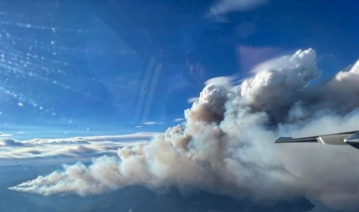
An aerial view of the McDougall Creek wildfire this morning, taken by BC Wildfire.
Image Credit: BC Wildfire
August 18, 2023 - 6:10 AM
Dramatic winds fanning the McDougall Creek wildfire in West Kelowna did their damage last night, but we're not out of the woods yet.
More gusty winds and a risk of dry lightning and thunderstorms remains in the forecast this morning for much of the B.C. Interior and Mountain passes. Environment Canada has extended its weather alert to this afternoon.
It's calling for winds to shift from westerly or southwesterly last night to northwesterly with gusts at 20 to 40 km/h.
"Instability near and behind the cold front may lead to the development of thunderstorms today, The main hazard is localized severe winds with speeds up to or above 70 km/h and dry lightning (lightning that comes with little or no rain)," the weather alert says.
While this is an obvious risk to the growing wildfire threat in the Central Okanagan, there's another potential hazard. The weather office also warns about drought-stricken trees potentially falling in the wind.
One small reprieve: The extreme heat warning that has baked the Southern Interior for the last week has ended.
For the latest on the wildfire situation and evacuations, go to cordemergency.ca.
To contact a reporter for this story, email Marshall Jones or call 250-718-2724 or email the editor. You can also submit photos, videos or news tips to the newsroom and be entered to win a monthly prize draw.
We welcome your comments and opinions on our stories but play nice. We won't censor or delete comments unless they contain off-topic statements or links, unnecessary vulgarity, false facts, spam or obviously fake profiles. If you have any concerns about what you see in comments, email the editor in the link above. SUBSCRIBE to our awesome newsletter here.
News from © iNFOnews, 2023