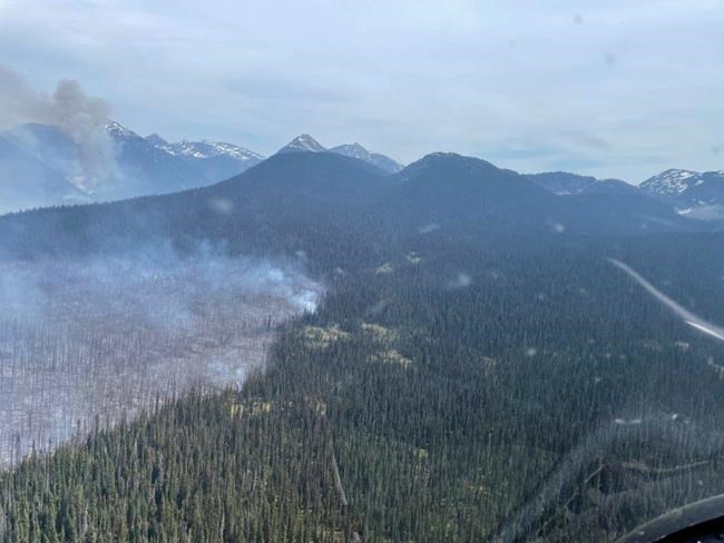
The Murtle Lake wildfire, located within Wells Gray Provincial Park, is shown in this handout photo provided by the BC Wildfire Service on Friday June 9, 2023. THE CANADIAN PRESS/HO-BC Wildfire Service
**MANDATORY CREDIT **
Republished June 12, 2023 - 9:20 PM
Original Publication Date June 12, 2023 - 8:11 AM
VANCOUVER - Hundreds more properties have been warned to be ready to evacuate on short notice after high winds fanned a massive wildfire in northeastern British Columbia that is the second largest in the province's history.
The Peace River Regional District issued the latest alert covering 370 more properties in remote areas north of Fort St. John Monday as winds whipped up the 4,660-square-kilometre Donnie Creek blaze.
The BC Wildfire Service says more than 140 people are working to contain the lightning-caused wildfire that was sparked on May 12, and is now surpassed in size by only the 2017 Plateau Fire at 5,210 square kilometres.
The service says winds responsible for the weekend trouble between Fort St. John and Fort Nelson aided firefighters on a separate blaze to the south, which prompted Thursday's evacuation of the entire northeastern community of Tumbler Ridge.
Gusts there have kept the nearly200-square-kilometre West Kiskatinaw River fire away from the threatened community of 2,400 located about 200 kilometres south of Fort St. John, although the evacuation order remains in effect.
Environment Canada is calling for showers in the northeast on Tuesday, with between five and 10 millimetres of rain in the Fort St. John area, although the weather office says there is also a risk of gusty winds and lightning.
In all, five wildfires of note are among more than 80 blazes throughout B.C.
That includes the stubborn 2.5-square-kilometre fire burning in steep terrain above Highway 4 on Vancouver Island, forcing the continued closure of the main route to Port Alberni, Tofino and Ucluelet.
A statement from the Ministry of Transportation on Monday says there's no estimate for when the route might reopen, and an update on the condition of the highway is expected Tuesday.
It says the province is assessing slope conditions and the danger of trees and debris tumbling down to the route that's been closed for a week.
Convoys of trucks are scheduled twice each day to deliver gas, food and other essential goods to the cut-off communities using a rough, four-hour detour.
All other drivers are asked to travel only for essential purposes.
This report by The Canadian Press was first published June 12, 2023.
Note to readers: This is a corrected story. An earlier version incorrectly stated that the Peace River Regional District issued an evacuation order covering 370 more properties Monday. Those properties are actually under evacuation alert.
News from © The Canadian Press, 2023