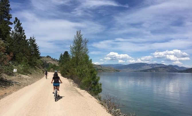
The Okanagan Rail Trail, from Coldstream to Kelowna, is the first major link in a cycle route from Sicamous to Osoyoos.
Image Credit: From Tourism Kelowna web page.
May 31, 2019 - 6:00 AM
KELOWNA - The long-standing dream of a hiking/biking trail from Sicamous to Osoyoos could become half a reality within a couple of years. But the rest may be a long way off.
A major reason for the delay is the fact that there never was a rail line connecting Kelowna to the south so geography is a major hurdle in that section.
But much progress has been made in just the last three years since iNFOnews.ca last reported on progress of the rail trail of the Okanagan (whatever the name may ultimately become).
For one thing, tens of thousands of people are already using the Okanagan Rail Trail (really more of a Coldstream to Kelowna rail trail) even though it won’t be fully connected until early 2020.
For another thing, much progress has been made on the Sicamous-to-Armstrong section of the trail. The land is under local government ownership and money is starting to flow in to develop the trail.
“Within two to three years, Sicamous to Kelowna will be completely connected,” Mike Overend, of Thompson Okanagan Tourism Association told iNFOnews.ca. “I think it will definitely be connected in that time. Kelowna to Osoyoos is a different issue.”
The huge and rapid success of the Kelowna to Coldstream Okanagan Rail Trail has shown what can be done, given the right kind of political and community support.
SICAMOUS TO ARMSTRONG
The CP Rail line from Sicamous to Armstrong was decommissioned about 10 years ago.
The Splatsin Indian Band took the initial steps to buy the land running through their territory. They want on to spearhead an effort to get two regional districts (Columbia-Shuswap and North Okanagan) along with a dozen municipalities and electoral areas, to buy up the rest for about $6.5 million, Phillip McIntyre-Paul, Executive Director of Shuswap Trail Alliance told iNFOnews.ca.
Final acquisition was completed in late 2017.
Since then, an application for $13 million has been made for federal/provincial infrastructure funding to develop the trail.
A public fundraising drive, as was done with the Coldstream to Kelowna trail, is not feasible in the largely rural northern section, Mcintyre-Paul said.
To date, $800,000 in funding has been received for detailed design and planning for upgrading the route. The hope is to get word on the $13 million grant request this summer.
That will create a rail trail in the north similar in scope and length (roughly 50 kms) to the existing Coldstream to Kelowna trail.
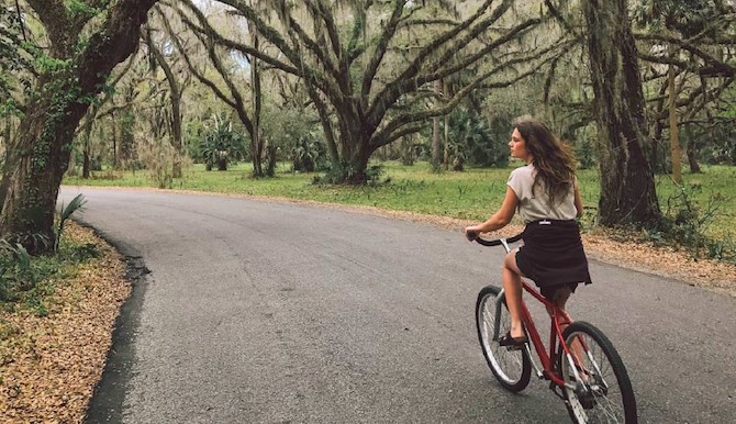
The Sicamous to Armstrong link will be the next major connection.
Image Credit: Submitted by Columbia Shuswap Regional District
ARMSTRONG TO COLDSTREAM
The missing piece is from Armstrong to Coldstream.
It can’t be along an abandoned rail line since CN Rail is still running trains on that spur line.
There are discussions with CN about allowing a trail beside the rail line.
There are also back road cycling options and Vernon has been working to find bike routes through the city so, while it may not be along a rail line, there will likely be off highway connections.
COLDSTREAM TO KELOWNA
The 50 km abandoned CN rail line was purchased by local governments for $22 million in 2015. The idea was so popular with politicians that Kelowna even lent money interest-free to Lake Country to help make it happen.
It only took three years for a community group, called the Okanagan Rail Trail Initiative, to raise $7.8 million to develop the trail along the old rail bed. It officially opened last fall, although a short section (roughly seven kilometres from Kelowna Airport to Lake Country) won’t likely open until early 2020. Completion is dependent on the federal government turning over ownership of 2.5 km along Duck Lake to the Okanagan Indian Band and the Band formally authorizing its use as part of the trail.
The original volunteer group that worked with local governments to pull the project together has rebranded itself as Friends of Okanagan Rail Trail and is continuing to raise money for trail enhancements.
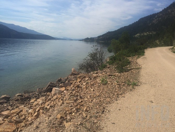
A stretch of the Okanagan Rail Trail along Kalamalka Lake.
(ROB MUNRO / iNFOnews.ca)
KELOWNA TO SUMMERLAND
Historically, freight was taken by boat up and down Okanagan Lake because steep terrain along both sides of the lake make rail lines impractical.
This is where geography prevents a true rail trail the whole length of the valley.
There is, of course, the Kettle Valley Railway, but that never connected to Kelowna. It ran from Midway to Penticton then past Summerland to Hope. It is about 900 metres higher than downtown Kelowna – a formidable challenge for all but the fittest mountain bikers.
“I don’t know if there’s ever going to be a legitimate connection on the KVR side, unless there’s a private company that provides a shuttle system,” Overend said.
The more likely option is along the west side of Okanagan Lake.
From the Okanagan Rail Trail terminus in Kelowna’s North End, there are waterfront pathways to the Bennett Bridge and a good cycle/walkway along the south side of the bridge connecting to Campbell Road and on through Kalamoir Park.
Then it’s busy roadways up to Highway 97 and down Drought Hill into Peachland.
The City of West Kelowna has plans for a waterfront trail but there are major property owners along the route that are not keen on granting easements.
At the south end, getting to the top of Drought Hill on Highway 97, is Goat's Peak. That is being developed as a regional park but, again, a private landowner stands in the way of it connecting to Gellatly Bay.
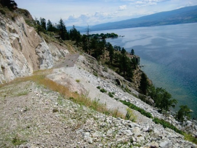
Goats Peak Regional Park will provide some off highway cycling only if access is allowed - or bought from - a private land owner in West Kelowna.
Image Credit: Submitted by Regional District of Central Okanagan
Then there is the challenge of Drought Hill down into Peachland. Gellatly Bay Trails and Parks Society President, Bruce Dalrymple, had proposed a $200,000 retaining wall below the highway but the province is insisting it be anchored to bedrock, which could cost $6 million, effectively killing that option. The Highways ministry is looking at either building a bypass around Peachland or upgrading the existing roadway. That could leave the old highway as a more cycle-friendly local road or create an upgraded highway with a separated bike path.
There are bike routes through Peachland along the lake but that entails another crossing of Highway 97 to get to Hardy Falls and the big four kilometre climb to Antler’s Saddle lookout.
“From the Peachland side, the first two kilometres is an easy climb,” Don Gemmell, President of the Trail of the Okanagans wrote in an email. “Then one must navigate a couple of steeper switchbacks and rough surface. I would say that the 4 km is not suitable for the average person to cycle.”
His group has a three stage plan to improve that trail so it can be cycled but, regardless of how good the trail is, it will still be a significant climb.
From there it’s 12 km downhill by road through the Garnett Valley to get back to an actual rail line, this time it’s the Kettle Valley Railway.
SUMMERLAND TO OSOYOOS
Back on flatter ground doesn’t mean the going is any easier as far as getting an active rail trail established because of jurisdictional and environment concerns.
The rail line from Summerland to Kaleden is mostly through Penticton Indian Band land. While access has not been denied, the Band has not formerly designated it as a trail and don’t maintain it.
From Kaleden to Okanagan Falls there is a good trail along the west side of Skaha Lake, maintained by the Regional District of the South Okanagan.
But south of there is Vaseux Lake.
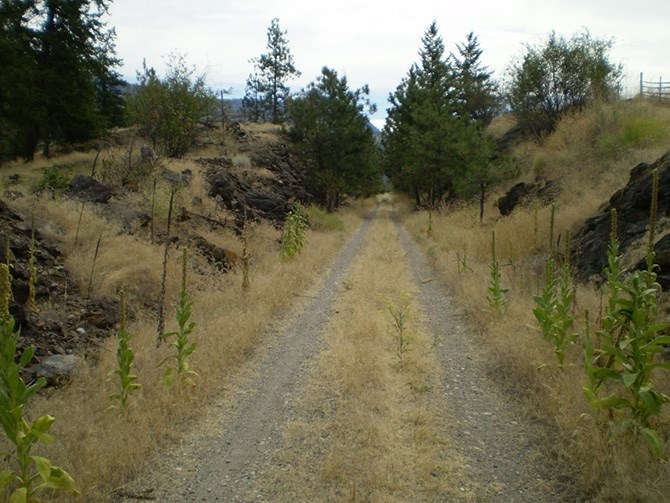
The Regional District of Okanagan Similkameen wants to open the Kettle Valley Railway line on the west side Vaseux Lake to public use.
Image Credit: Wikimedia commons
The rail line runs on the west side of the environmentally sensitive lake so the provincial government is opposed to any trail development, leaving Highway 97 as the only alternative. That’s the subject of long standing and continuing discussions between the province and regional district.
South of Vaseux Lake, there is about 26 kilometres of trail, some on the old Kettle Valley line that is maintained by the regional district and some unmaintained but well used trail along the Okanagan River channel.
Parts of the rail line run through private property. While it’s owned by the provincial government and discussions have been held with landowners, it’s unclear whether it will become part of the trail.
That takes travellers to the north end of Osoyoos Lake.
“Unfortunately, there is no rail trail or linear trail opportunities along that lake or along that corridor,” Justin Shuttleworth, Parks and Facilities Manager for the Regional District of Okanagan Similkameen said.
Unlike in most places, the Kettle Valley Railway spur lines through Osoyoos have mostly been sold off and are not available for public use, Shuttleworth said.
There are some bike routes through the town and work continues but those efforts are moving slowly.
NEXT STEPS
While the Sicamous to Armstrong section is moving ahead and various groups and governments move slowly on other parts of the trail, there is no overall co-ordinating body.
A couple of years ago, as part of his job with the tourism association, Overend held a meeting of all interested parties between Osoyoos and Sicamous to discuss a coordinated effort for the whole route. It was a good meeting but “the conversation stalled” after at least one key player stepped aside, Overend said.
Another meeting needs to be set up, he said. He will work on doing just that in the fall.
The Association set up the B.C. Rail Trail web site that, currently, focusses on the Kettle Valley route. Overend plans to do a complete overhaul of that site this summer to add in the Okanagan Rail Trail and include other routes in the Okanagan and Kootenays.
WHAT’S IN A NAME?
The Sicamous to Armstrong initiative is dubbed the Rail Trail Initiative or the Rail Trail Corridor by the Columbia-Shuswap Regional District.
The Coldstream to Kelowna section is called the Okanagan Rail Trai.
There is the Trail of the Okanagans group based out of Summerland.
There is the B.C. Rail Trails website set up by the Thompson Okanagan Tourism Association that, currently, only features the Kettle Valley Railway.
Trails B.C. is a group with a view to all trails in the province.
There isn’t a name for the entire trail network, as of yet.
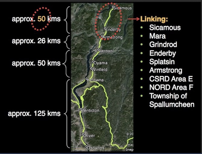
This map shows the entire rail trail of the Okanagan Valley.
Image Credit: From Shuswap Trails web site.
To contact a reporter for this story, email Rob Munro or call 250-808-0143 or email the editor. You can also submit photos, videos or news tips to the newsroom and be entered to win a monthly prize draw.
We welcome your comments and opinions on our stories but play nice. We won't censor or delete comments unless they contain off-topic statements or links, unnecessary vulgarity, false facts, spam or obviously fake profiles. If you have any concerns about what you see in comments, email the editor in the link above.
News from © iNFOnews, 2019