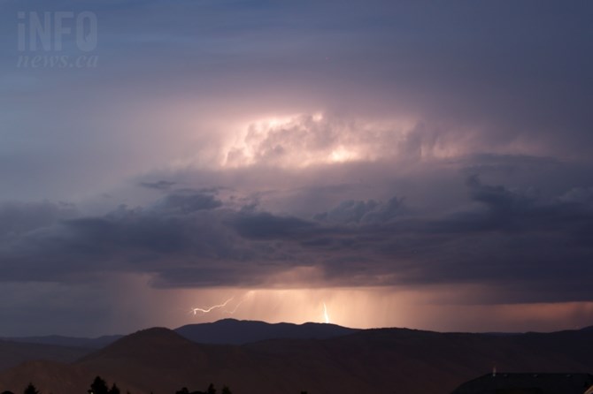
FILE PHOTO
(JENNIFER STAHN / iNFOnews.ca)
August 11, 2022 - 9:06 AM
A severe thunderstorm watch has been issued for a big chunk for the B.C. Interior including the Okanagan, South Thompson, Shuswap, Nicola, Similkameen and Boundary regions.
The conditions are just right for the severe thunderstorms to develop today, Aug. 11, and those thunderstorms could produce strong wind guts, large hail and heavy rain.
"Large hail can damage property and cause injury. Strong wind gusts can toss loose objects, damage weak buildings, break branches off trees and overturn large vehicles," the severe thunderstorm watch reads. "Intense lightning is likely with any thunderstorm that develops. Heavy downpours are likely to cause flash floods and water pooling on roads."
This comes with continued high temperatures and little or no rain for the past month.
The forecast is for Kamloops to reach 34 Celsius today with a 40% chance of showers or thunderstorms late this afternoon.
Tomorrow the forecast calls for the daytime high temperatures to reach 35 C in Kamloops with a mix of sun and cloud before dropping to a high of 29 C on Saturday with a 30% chance of showers. Sunny days are expected to return after that with highs reaching 35 C early next week.
READ MORE: Massive kids entertainment centre and eatery opening in Kamloops Industrial Park
For the Okanagan, highs are expected to reach 31 C today with a 60% chance of showers or thunderstorms this afternoon. There’s a 30% chance of showers on Friday and 40% chance on Saturday before the sun returns full time on Sunday. Highs are expected to drop to around 28 C on the weekend then climb back to the low 30s next week.
Normal temperatures for this time of year are between 27C and 28 C.
There has been no rain recorded in Kelowna or Penticton since July 5 with 2.1 to 2.4 millimetres tallied for all of July.
Vernon was wetter with 0.5 mm of rain falling on Aug. 5 but no rain before that since July 6. That city recorded 4.4 mm of rain in July.
Kamloops got 1.3 mm of rain on Aug. 4 and 5 but only 0.4 mm for all of July.
For the latest on the severe thunderstorm watch go to Environment Canada's public weather alert page here.
READ MORE: Kelowna’s Rock the Lake already selling tickets for next year
A special air quality statement was issued early this morning for the South Okanagan and into the Kootenays as the Keremeos Creek Wildfire continues to burn.
It’s now covered 6,712 hectares. The increase in size over the last few days is attributed to controlled burns and more accurate mapping.
It’s still considered an active wildfire.
— This story was updated at 9:06 a.m. Thursday, Aug. 11, 2022, with more information from Environment Canada.
To contact a reporter for this story, email Rob Munro or call 250-808-0143 or email the editor. You can also submit photos, videos or news tips to the newsroom and be entered to win a monthly prize draw.
We welcome your comments and opinions on our stories but play nice. We won't censor or delete comments unless they contain off-topic statements or links, unnecessary vulgarity, false facts, spam or obviously fake profiles. If you have any concerns about what you see in comments, email the editor in the link above.
News from © iNFOnews, 2022