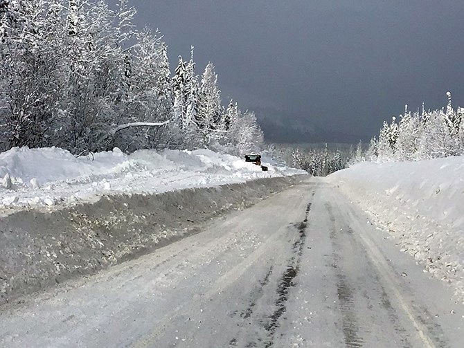
This is the scene on Highway 37 north of Meziadin Junction in Northern B.C. Tuesday, Jan. 26, 2021 as Dawson Road Maintenance-Bulkley Nass road crews work to clean up more than 700 cm of snow that has fallen in the past few weeks.
Image Credit: FACEBOOK/Dawson Road Maintenance-Bulkley Nass
January 26, 2021 - 3:00 PM
This week’s weather in Kamloops and the Okanagan has marked a return to marginally winter conditions compared to what we’ve experienced so far this season.
The region has been dealt with a surprisingly benign weather hand in spite of earlier predictions to the contrary, with limited snow and precipitation and temperatures, for the most part, above average for this time of year.
We’re seeing a return of the gloomy skies and light snowfall that often defines our Interior B.C. winters this week, but if you think that’s a reason to complain, take a look at what is taking place in other locales across North America this week.
In northern B.C., Dawson Road Maintenance - Bulkley Nass is busy today clearing heavy snow from Highway 37 between Meziadin Junction and Deltaic Creek. In excess of 700 centimetres has fallen in the region over the past few weeks.
The Weather Network is forecasting some extreme weather for California, starting today, Jan. 26, and running through Sunday, as an atmospheric river is poised slam into the state. Predictions for as much as 86 inches of snow are being made for the Mammoth Lake area, with drenching rain expected for coastal and valley areas, and a widespread chance of flooding and debris flows as a result of the huge wildfire burns that took place in the state last year.
Extreme cold warnings have been issued for a large portion of the prairies today, with wind chills to -40 Celsius and colder for parts of Saskatchewan and Manitoba, although Environment Canada meteorologist Doug Lundquist says those temperatures aren’t expected to last.
READ MORE: Foot of snow blankets parts of Midwest, disrupts travel
Further south, Omaha, Nebraska, is digging out from a foot deep dump of snow that fell yesterday, Jan. 25. Weather Network meteorologist Mike Seidel says the city hasn’t seen that much in one event since 2005, and there have been only 10 days in the past 140 years where more than 10 inches of snow has fallen. The forecast is also calling for those chilly temperatures from the Canadian prairies to move in after the snow stops.
To the east, Toronto and southern Ontario are digging out following a five to 10 cm snowfall, with a forecast calling for freezing rain as the second half of the system moves through today. Ontario has had a relatively easy winter - up to this point - as well. Travel advisories have been issued warning of poor visibility and rapidly accumulating snow on roadways.
To contact a reporter for this story, email Steve Arstad or call 250-488-3065 or email the editor. You can also submit photos, videos or news tips to tips@infonews.ca and be entered to win a monthly prize draw.
We welcome your comments and opinions on our stories but play nice. We won't censor or delete comments unless they contain off-topic statements or links, unnecessary vulgarity, false facts, spam or obviously fake profiles. If you have any concerns about what you see in comments, email the editor in the link above.
News from © iNFOnews, 2021