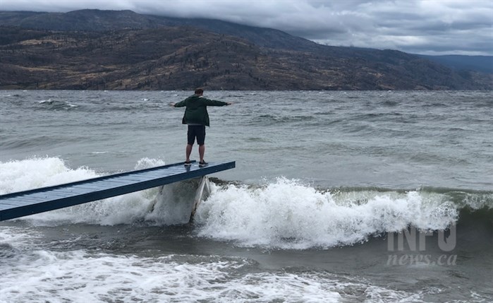
FILE PHOTO
Image Credit: Kathy Michaels
October 25, 2021 - 8:44 AM
The so-called “bomb” cyclone hammering Vancouver Island and the Lower Mainland today will weaken by the time it hits Kamloops and Okanagan regions later today.
“What we’re going to see today are pretty widespread 30 km/h winds gusting to 40 and maybe even some 40 gusting to 60 and some moisture,” Environment Canada meteorologist Armel Castellan told iNFOnews.ca today, Oct. 25.
It’s looking like the winds and moisture will be greater than what’s been forecast up to now, he said.
“A shower today is not out of the question but it’s into the evening here where the frontal passage, the cold front, is going to swing through the Interior,” Castellan said. “We’re likely to see dropping freezing levels so the Okanagan Connector as well the Coquihalla summit could see some accumulation of snow.”
The forecast is for two to four centimetres of snowfall at higher elevations but that could change as the day progresses so he suggested travellers check with Drive B.C. if they’re going to be driving through the mountain passes.
The term “bomb” cyclone is actually more commonly used by the American Meteorological Society, Castellan said. In Canada it tends to be called a weather bomb.
Regardless, it’s an area of rapidly falling low pressure that creates strong winds and rain.
Weather warnings have been issued for Vancouver Island and the Lower Mainland where winds could gust as high as 100 km/h.
READ MORE: Powerful storm hits B.C. south coast, thousands without power but no reported damage
Despite that, the province is getting off lightly.
“It really a very quick deepening and strengthening of a really large scale low pressure system,” Castellan said. “What’s interesting is that, for the most part, we’re getting away with not an extraordinary amount of impact. The reason for that is the intensification is happening offshore and by the time it makes landfall later today we’re looking at the de-escalating of the lowest pressures.”
Still, this is an historic storm as the winds will be intense for about 24 hours. Normally, such storms are “done and dusted” within 10 to 12 hours, he said.
“It will be a ghost of its former self by the time it gets to you,” Castellan said, noting that it can no longer be classified as a “bomb” cyclone when it reaches the Thompson-Okanagan.
While it should move through the Interior by Wednesday, leaving a somewhat clear day, another system is heading into the Thompson-Okanagan right behind. It’s expected to bring rain on Thursday but how much is still not clear, Castellan said.
The online Environment Canada forecasts call for relatively warm fall temperatures from 10 Celsius to 12 C in the Okanagan and somewhat warmer in Kamloops, reaching a high of 16 C on Thursday.
But, overnight lows are, right now, are forecast to drop to 2 C by the weekend.
To contact a reporter for this story, email Rob Munro or call 250-808-0143 or email the editor. You can also submit photos, videos or news tips to the newsroom and be entered to win a monthly prize draw.
We welcome your comments and opinions on our stories but play nice. We won't censor or delete comments unless they contain off-topic statements or links, unnecessary vulgarity, false facts, spam or obviously fake profiles. If you have any concerns about what you see in comments, email the editor in the link above.
News from © iNFOnews, 2021