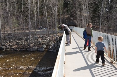
Mission Creek Regional Park draws the crowds on a sunny spring day.
(JULIE WHITTET / iNFOnews.ca)
March 27, 2013 - 5:00 PM
By Julie Whittet
As we welcome the first warm days of spring in the Valley, up in the mountains, the snow will soon begin to melt.
This spring the Okanagan is facing a higher than usual flood risk, according to the latest survey of the region's snowpack. The B.C. Snow Basin Indice shows the Okanagan-Kettle Valley area is at 115 per cent of its annual average for snow levels.
David Campbell of the BC River Forecast Centre says the extra 15 per cent tells us there's a little bit more snow than normal.
“Anything past 110% gives an abnormal risk,” he says, but adds that indices between 120 and 130 per cent signal greater trouble. He says the numbers reflect a lumped assessment for the whole basin. Some areas, like the east side of Okanagan Lake, are more affected than others.
While the spring freshets — or snow melt — reaches peak flows in May and June, Campbell says we can expect water levels to start rising by mid-April. The Forecast Centre is paying particular attention to water flow through the Mission Creek River.
“It's the one major river body we tend to have issues on,” Campbell says.
While a generous snow pack can be hazardous for spring flooding, it's good news for the city's water reservoirs.
Tobey Pike, general manager for the South East Kelowna Irrigation District, says measuring snowpack levels helps them gauge the amount of spring run-off to expect.
In 2009, the district put in water restrictions when they got only 67% of their expected runoff, Pike says.
“We really had to cut back farmers.”
But as of last Thursday, land owners and farmers in South East Kelowna got the green light on their normal water allotment for the year.
“We're confident we have adequate supply,” Pike says.
For now, the forecast centre says to stay tuned for the next assesment on the first of April. Campbell says this will give people a better picture of the flood risk.
“There should be a bit more snow, given the recent weather patterns.”
To contact the reporter for this story, email Julie Whittet at jwhittet@infotelnews.ca or call (250) 718-0428.
News from © iNFOnews, 2013