
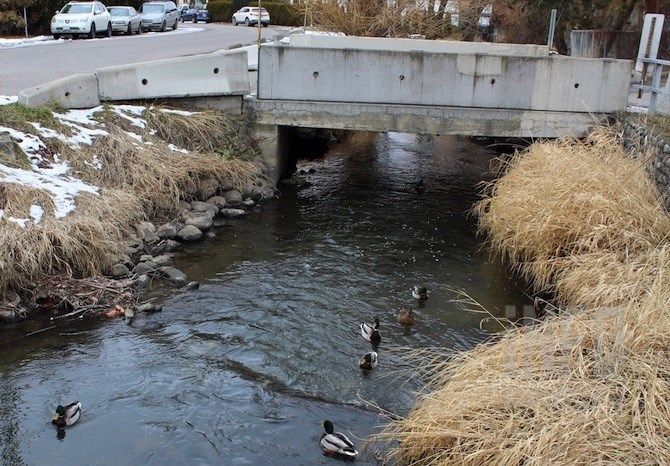
Mill Creek in Kelowna may look placid now but high groundwater could contribute to flooding this spring.
(ROB MUNRO / iNFOnews.ca)
February 04, 2019 - 4:40 PM
KELOWNA - After two years of spring floods it’s easy to get complacent when this year’s snow pack is average and a warm, dry January makes it look like spring is almost here.
But there’s a seeping concern lurking just under the surface as record high levels of groundwater are already pushing creeks to historically high levels.
“All the indicators are there, showing we still need to be diligent with regard to the possibility of flooding,” Don Dobson told iNFOnews.ca.
Dobson spent 17 years with the federal and provincial governments studying Okanagan water issues and is now the head of Dobson Engineering Ltd.
“It looks like it’s going to be a more normal snowpack and hopefully a more normal runoff,” he said. “Based on the fact the water table is higher in a number of locations and the streams are flowing higher in January than under normal conditions, we need to be vigilant.”
Mill Creek, which wends its way past Kelowna International Airport through built-up areas of the city before entering Okanagan Lake just south of the Bennett Bridge, could overflow its banks and soak neighbouring apartment buildings and residential lots.
Mill Creek near Okanagan Lake in Kelowna has been dredged and trees have been cut down to minimize the risk of future flooding.
(ROB MUNRO / iNFOnews.ca)
“Most of the problems we’ve experienced (in 2017 and 2018) was in the lower reaches downtown, where channel capacity was very restricted,” explained Fred Schaad, project manager for the City of Kelowna. “But there are still some real channel capacity issues.”
Much of Mill Creek is walled in through the built-up part of the city so it can only handle a maximum of four cubic metres of water per second. There is a diversion channel upstream of Dilworth Drive that can shift 11 cubic metres over to Mission Creek.
But a one-in-200-year flood would force 25 cubic metres per second down Mill Creek, meaning 10 or 11 cubic metres more than the creek can hold. Long term that may mean building a second diversion tunnel but that would only shift more water into what would also be a full Mission Creek.
Last year, Mission Creek water peaked just under the KLO Road bridge.
Given the high creek flows of the past two years many creeks throughout the Okanagan were badly eroded and large deposits of material may affect the flows this year, Dobson said.

Work will start next week to clean out parts of Bellevue Creek in Kelowna.
(ROB MUNRO / iNFOnews.ca)
Parkrill Creek near Oliver started flooding the Sportsman Bowl Road area even before the major snow melt in 2018. When Twin Lakes flooded later in the season, water had to be pumped down that creek, possibly lengthening the time residents were evacuated.
Bellevue and Scotty Creeks are a concern in Kelowna, as are Shorts, Lambly, Powers and Peachland Creeks on the Westside.
Work will begin next week on increasing the capacity of Bellevue Creek near Gordon Road and Lakeshore Road to fend off possible flooding this year.
The City has already spent $5 to $6 million on stream flow improvements, Schaad said. The province paid 80 per cent of costs that were due to flooding or increasing flows where there had been flooding. Any purely preventative measures have to be paid 100 per cent by the City.
The concern for Dobson all boils down to high groundwater, especially in the Central and South Okanagan.
He’s monitored wells throughout the region and compared them to 2016 levels, which are more typical of historical patterns before the unusually high levels of the last two springs.
Each test well has individual characteristics based on factors such as how deep it’s drilled, the type of aquifer it taps and whether water is being drawn off that aquifer for human use.
In general, the wells are higher than in 2016 and that’s contributing to creeks being higher at this time of year – due to ground water flows, not snow melt.
And even if an individual well shows the water table is a few metres below the surface, that doesn’t mean there’s nothing to worry about since the downstream areas where the water normally seeps out of the ground and into streams are now higher up the slopes.
The reason the groundwater is so high dates back two years when the snowpack was normal but heavy rains fell in the spring and saturated the ground.
“In 2017, with the extreme amount of runoff we had, that brought the lake up to the highest level we’ve ever seen it,” Dobson said. “As they were able to bring the lake down, we didn’t see a response from groundwater that we had anticipated.”
While there are concerns that any Central or South Okanagan creeks could flood, Dobson is expecting only “localized” flooding – meaning a few properties in upstream areas. That could change drastically if heavy rains fall on an already waterlogged ground.
To contact a reporter for this story, email Rob Munro or call 250-808-0143 or email the editor. You can also submit photos, videos or news tips to the newsroom and be entered to win a monthly prize draw.
We welcome your comments and opinions on our stories but play nice. We won't censor or delete comments unless they contain off-topic statements or links, unnecessary vulgarity, false facts, spam or obviously fake profiles. If you have any concerns about what you see in comments, email the editor in the link above.
News from © iNFOnews, 2019