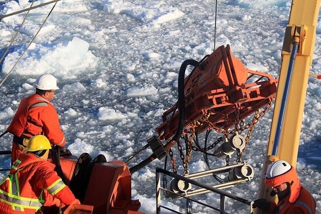
Seismic gear is deployed from the CCGS Louis S. St-Laurent in the Arctic Ocean in a 2015 handout photo. A 2,100-page report has been submitted to the United Nations that Canada will use to argue for control over a vast region of the Arctic sea floor.
Image Credit: THE CANADIAN PRESS/HO- Geological Survey of Canada, Natural Resources Canada
June 02, 2019 - 9:00 PM
One minute, it was dangling off the back of an icebreaker into the waters of the High Arctic. The next, the crucial piece of gear was gone.
"We got pinched," recalls Mary-Lynn Dickson. "You're clearing a path, but the ice moves in and we got pinched."
Dickson was the lead scientist on a 2,100-page report just submitted to the United Nations that Canada will use to argue for control over a vast region of the Arctic sea floor.
It was 2016. She was on her third expedition far north of Ellesmere Island, and the ice had just clipped the team's last underwater microphone, called a streamer.
Without it, there was no way to record signals rebounding off the sea floor — the whole point of the trip.
They were hundreds of kilometres from anywhere. The first rule of Arctic science was in force: If something breaks, you fix it or you don't have it.
Dickson threw the ball to her technical team.
"By the next morning they said, 'We can build a new one out of spare parts,'" she says. "We called it the Frankenstreamer. It wasn't pretty, but it worked."
Thanks partly to the Frankenstreamer, Canada makes a strong case that the North Pole is part of its True North, Dickson says.
All coastal nations claim 200 nautical miles off their shores as exclusive economic zones.
Beyond that may lie something call the extended continental shelf. If a country can prove that the shelf exists off its coast and that it's connected to the country's land mass, it can be claimed.
Peering through sometimes thousands of metres of icy water to prod the bottom beneath was what Dickson and her colleagues on the Coast Guard's Louis St. Laurent were trying to do.
The task was large and time was short. The science agenda was packed and almost every hour of the cruise was accounted for.
Researchers looked at the thickness and origin of sediment layers.
They made precise measurements of water depth.
They analyzed geochemistry.
They considered the type, age and structures of rocks hauled from the deep. "They're so precious they're like moon rocks," Dickson says.
They reconstructed how the modern sea floor was built from ancient tectonic plates.
They compared the rocks they were finding with data collected on High Arctic islands.
"It all pulled it together in making a complete package and, I think, convincing arguments as to why this continental margin is part of the land mass," Dickson says. "It's connected to the Canadian continental margin off of Ellesmere Island — physically connected."
All this happened through ice so tough it sometimes stymied two icebreakers and so unpredictable the team lost two locator beacons when the ice pan they were on drifted away. They were recovered nine months later east of Greenland by the Danish navy.
Scientists worked on the St. Laurent's back deck through freezing winds, blizzards, thick fog and bright sun.
"It was beautiful," Dickson says. "I loved it."
Russia and Denmark, which have made competing submissions to the United Nations, also argue that two undersea ridges beneath the Arctic Ocean are connected to their land masses. Maybe they're right, says Dickson.
"They can be. You can all be right. I don't want to speak for the Russians or the Danes, but I think we all agree the Lomonosov Ridge is continental material."
The work, which cost $43 million over the three cruises, is now before the UN commission that is to examine data from the three countries to ensure the science has been done correctly.
It will take years of negotiations between the three to draw any lines on the map. The action will move to meeting rooms and conference centres.
Dickson much preferred the rear deck of a windswept icebreaker. She calls her Arctic sailings a highlight of her career.
"I was 20 years old again on the back of that ship."
News from © The Canadian Press, 2019