Image Credit: Shutterstock
December 26, 2014 - 4:40 PM
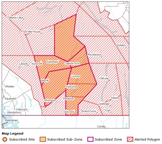
THOMPSON-OKANAGAN – Its back to winter-like conditions in the Thompson-Okanagan Sunday as Arctic air pushes south dropping temperatures and creating snow.
Environment Canada has issued a special weather statement warning temperatures will drop to at least ten degrees below normal for this time of year and dumping large amounts of snow on the mountain passes.
A strong ridge of high pressure from Yukon will advance toward the B.C. Interior overnight Saturday and Sunday morning, according to forecasters.
The frigid air associated with the ridge will spread from north to south dropping daytime highs in the region to around -6 C by Tuesday. The cold is expected to hang around for at least until New Year’s Day on Thursday.
A disturbance preceding the Arctic air will bring heavy snow to the high elevation highways beginning overnight Saturday. Between 10 to 20 centimetres of snow are expected by midnight.
The air mass will dry out and the snow will taper to flurries as it moves south.
The Okanagan Connector between Kelowna and Merritt will likely see most of the snow.
In the valleys, the forecast is calling for up to five cm of snow Saturday night with flurries Sunday and Monday.
For the very latest weather forecasts go to Environment Canada’s website.
Current driving conditions can be found at Drive B.C.

Image Credit: Environment Canada
To contact the reporter for this story, email Howard Alexander at halexander@infonews.ca or call 250-491-0331. To contact the editor, email mjones@infonews.ca or call 250-718-2724.
News from © iNFOnews, 2014