
Smoke from the wildfire burning in the Joe Rich area east of Kelowna can be seen for kilometres, Thursday, Aug. 24, 2017.
(ADAM PROSKIW / iNFOnews.ca)
Republished August 24, 2017 - 5:10 PM
Original Publication Date August 24, 2017 - 2:46 PM
KELOWNA - An evacuation order has been issued for the entire Joe Rich area east of Kelowna as crews battle an out of control wildfire.
At about 1:30 p.m., firefighters were called to the blaze along Highway 33 at Philpott Road.
B.C. wildfire estimates the Philpott Road wildfire is 300 hectares in size and is burning out of control.
Along with firefighters from the Joe Rich Fire Department and the Kelowna Fire Department, B.C. Wildfire has fire crews, helicopters and air tankers working the blaze.
The Central Okanagan Emergency Operations Centre says an evacuation order has been issued for the entire area of Joe Rich, from Walker Hill on the Highway 33 western boundary of the City of Kelowna to Big White Road to the east and Mission Creek and Joe Rich Creek along the south. This affects approximately 474 properties and an estimated 1,100 people.
A detailed map showing affected properties is available at www.cordemergency.ca.
RCMP says they are presently executing emergency evacuation orders for the following areas:
-
Goudie Road;
-
Huckleberry Road;
-
Daves Road;
-
Goshawk Road;
-
Hawk Road;
-
Falcon Road;
-
Falconridge Crescent;
-
Sun Valley Road;
-
Cardinal Creek Road;
-
Peregrine Road;
-
Philpott Forest Service Road;
-
Three Forks Road;
-
Thelwell Road;
-
Greystokes Road;
-
Dion Road; and
-
Schram Road;
RCMP say in a media release that in order to ensure public safety and the ability for emergency crews to access the area, officers have closed Highway 33 East in both directions between Goudie Road and Schram Road. RCMP ask that the public avoid the area and plan a different route in order to assist in the safe evacuation of all affected residents.
An Emergency Support Services reception centre is being established at Willow Park church on Highway 33 in Kelowna. It will be open to help residents starting at 5:00 pm.
For the very latest updates and information go to the Central Okanagan Emergency Operations website here.
You can follow Emergency Operations on Facebook here or on Twitter here.
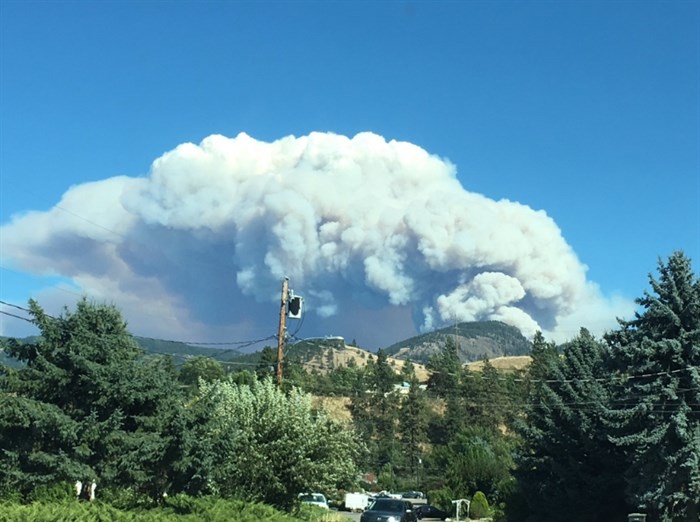
Image Credit: Twitter via Al Smith @literateowl
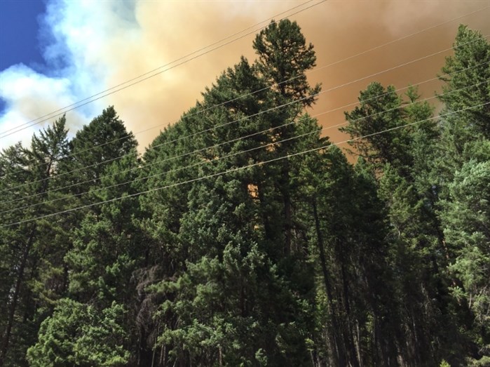
Image Credit: Twitter via @teamtakedown1
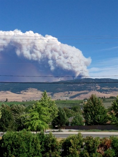
Philpott Road wildfire
Image Credit: TWITTER/Sarina @valaxiom
— This story was updated at 3 p.m and 3:30 p.m. Thursday, Aug. 24, 2017 to include new information from the EOC and RCMP.
— This story was updated at 3:45 p.m. Thursday, Aug. 24, 2017 to include photos and video from social media.
— This story was updated at 4 p.m, Thursday, Aug. 24, 2017 to update the size of the evacuation order to include all of Joe Rich.
— This story was updated at 5:08 p.m. Thursday, Aug. 24, 2017 to say the fire had grown to about 300 hectares.
To contact a reporter for this story, email Adam Proskiw or call 250-718-0428 or email the editor. You can also submit photos, videos or news tips to the newsroom and be entered to win a monthly prize draw.
We welcome your comments and opinions on our stories but play nice. We won't censor or delete comments unless they contain off-topic statements or links, unnecessary vulgarity, false facts, spam or obviously fake profiles. If you have any concerns about what you see in comments, email the editor in the link above.
News from © iNFOnews, 2017