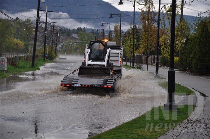
FILE PHOTO: Work crews begin remediation work on Gellatly Road, covered by floodwaters, on May 5, 2017.
(MARSHALL JONES - MANAGING EDITOR / iNFOnews.ca)
Republished May 08, 2017 - 4:20 PM
Original Publication Date May 08, 2017 - 1:00 PM
OKANAGAN - Flooded communities across the Thompson-Okanagan are getting a short reprieve over the next few days, but aren’t out of the water yet, according to Environment Canada.
Temperatures are expected to rise to around 26 C on Wednesday, followed by a storm making its way into the area on Friday, meteorologist Doug Lundquist says.
“That’s a bit concerning because it’s a similar pattern to what we saw (last week),” Lundquist says.
Last week, a spike in temperature and humidity caused rapid melting of the area’s snowpack, leading to flash flooding across the Thompson-Okanagan. The warmer weather followed a cooler than average spring, which meant there was more snow at lower elevations.
“This was the recipe,” Lundquist says. “To have warm weather and high humidity after a really cold period.”
Those conditions were compounded by a significant amount of rainfall as thunderstorms swept the valley.
“It wasn’t just one thing,” Lundquist says, noting the event could be described as the ‘perfect storm.’
What’s next is uncertain, but given the warming trend this week followed by more rain, Lundquist says residents should stay on alert.
“Definitely, we need to be in vigilance mode,” he says.
Lundquist reminds residents to be ready for anything and that flooding could come to new areas.
“If you skated over the past few days don’t assume you won’t be affected,” Lundquist says.
It’s possible that impacts will be less severe in areas that have already seen the most intense flooding because much of the snowpack in those places has already been released, Lundquist says. But, there are no guarantees and residents should be prepared for the worst.
“I want people to be calm and know that the next few days will be a quiet time, but we do have to remain vigilant later in the week,” Lundquist says.
He adds that this is just the beginning of the spring freshet, which typically runs from May to the end of June.
“By July, we’re out of the woods,” Lundquist says.
Dave Campbell of the B.C. River Forecast Centre says with higher elevation snowpack being released over the coming days, different creeks and rivers could be affected.
“The dynamics of the snowmelt are changing. Snow lines are moving up higher,” Campbell says. “There’s still lots of snow.”
Rivers and creeks in the area are high and the ground already saturated with water, which could create challenging conditions.
“When rivers are high there is less room to absorb more water,” Campbell says.
The public is being advised to stay off rivers and remain cautious anywhere near waterways. With all the moisture, river banks are soft and dangerous, Campbell says.
Additionally, those venturing into the backcountry should be mindful that roads can easily become washed out, potentially leaving you without a way out.
— This story was updated at 4:15 p.m. May 8, 2017 to include information from the B.C. River Forecast Centre.
To contact a reporter for this story, email Charlotte Helston or call 250-309-5230 or email the editor. You can also submit photos, videos or news tips to the newsroom and be entered to win a monthly prize draw.
We welcome your comments and opinions on our stories but play nice. We won't censor or delete comments unless they contain off-topic statements or links, unnecessary vulgarity, false facts, spam or obviously fake profiles. If you have any concerns about what you see in comments, email the editor in the link above.
News from © iNFOnews, 2017