Image Credit: Google Earth Engine
March 26, 2015 - 10:46 AM
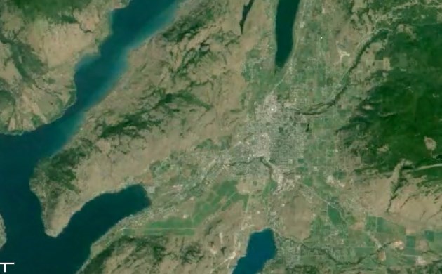
VERNON - It’s no surprise the Vernon area has grown over the last 30 years, but now you can see just what those changes look like from above.
This incredible time lapse of satellite images from 1984 to 2012 on Google Earth Engine shows how different the city looks today. You will see new building developments appear as the population doubles from around 20,241 in 1986 to 38,150 in 2011.
Zoom in and watch the Middleton Mountain subdivision fill in at the north end of Kalamalka Lake, and the Foothills neighbourhood appear on the east end of town. You can also see commercial expansion at the northern tip of the city when the Superstore and other developments took place. Scroll over to Silver Star Mountain Resort and watch the ski hill double its runs with the creation of the backside.
In the mountains around the city, you can also see the effect of logging operations — and reforestation — as patches of green recede and return.
Take a look and let us know what changes you see. Tell us in the comments below.
**Please note: This time lapse will not play on mobile devices.
Credit: Google Earth Engine
To contact the reporter for this story, email Charlotte Helston at chelston@infonews.ca or call 250-309-5230. To contact the editor, email mjones@infonews.ca or call 250-718-2724.
News from © iNFOnews, 2015