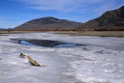
Snow pack will play a big part in how much flooding happens this year, though so far it looks like it should be a somewhat normal year in most of the region.
(JENNIFER STAHN / iNFOnews.ca)
March 14, 2014 - 3:30 PM
THOMPSON-OKANAGAN — Officials warn it is a bit early to start predicting flood levels but current snow pack levels show some parts of the region will likely be fending off high water levels later this spring.
“There's still a couple months of snowpack accumulation left,” Kamloops Fire Rescue Assistant Chief of Communications Dan Sutherland says.
Sutherland says while the weather is warming at lower elevations there is still a couple months of winter left at higher elevations, and the way spring rolls out at all elevations will play a huge roll in whether snowpack levels remain where they are. Snowpack accumulation is typically only at 80 per cent by early March, meaning a lot could change over the next two months, though current weather forecasts are favourable.
A River Forecast Centre March bulletin states seasonal forecasts from Environment Canada indicate a modest chance of above normal temperatures for the March to May period. It also says forecasts for seasonal precipitation do not indicate an increased likelihood of any particular precipitation trend through the spring.
Sutherland notes flood planning does not stop over the fall or winter. All communities try to ensure their plan to deal with a once in 20 year flood is as robust and complete as possible.
In Kamloops the last time an actual once in 20 year event occurred was in 1894, which actually turned into a once in 200 year event. Since then the only time the city has come close to seeing a once in 20 year flood was in 1972.
Emergency coordination crews are reviewing daily river level reports and working closely with the province, having at least weekly meetings as freshet begins, to examine snowpack, river levels and weather. Crews also work closely with city departments such as public works so catch basins and manholes can be closed as soon as river levels get too high.
Meanwhile Sutherland says they will keep an eye on conditions and pay close attention to forecasts.
“It's impressive how accurate some of these forecasts can be,” he says. “But it is just a forecast.”
Sutherland says as the warmer weather does come people should be aware the river will rise quickly and with it the current will pick up. For those going out on boats they should be careful of the debris that will start to flow with the river.
“Be vigilant on water,” he says. “The current increases greatly with higher water levels.”
Smaller creeks will also get going and can increase very rapidly in just a day.
“It can be dramatic. Exercise extreme caution,” Sutherland notes.
THE NUMBERS
Snowpack levels currently vary throughout the region, though on the South and North Thompson rivers levels are looking normal to just below normal, which is the state most basins in the province are currently in. The most extreme basins are the Upper Fraser and Northeast-Liard basins, both sitting at 137 per cent (the highest in the province) and the South Coast and Vancouver Island basins, which are both below 55 per cent (the lowest in the province.)
At the North Thompson basin snowpack levels are 91 per cent of normal, with levels ranging from 79 per cent at Azure River to 135 per cent at Blue River. The South Thompson currently sits at an average of 100 per cent but is seeing a range of 86 per cent at Celista Mountain to 127 per cent at Anglemont. In the Greater Vernon Water area, which is part of the South Thompson basin, snowpack is sitting at 118 per cent of average
The Middle Fraser, one of the largest regions with more than two dozen stations, sits an average of 95 per cent though the snowpack at Lac le Jeune currently sits at just 83 per cent. The rest of the stations in the region are reporting between 52 and 155 per cent of normal snowpack levels.
The Okanagan-Kettle region currently sits just below normal at 94 per cent though stations range from 48 per cent at Grano Creek in Kettle to 135 per cent at Trout Creek in Okanagan. Other notable stations in the region are Monashee Pass at 117 per cent, Silver Star Mountain at 95 per cent, Brenda Mine at 77 and 90 per cent and Mission Creek at 116 per cent.
In Similkameen the average snowpack across four stations is 118 per cent, with levels ranging from 101-141 per cent.
Seasonal volume runoff is expected to be higher than normal in the upper Similkameen basin but should be near normal for the Thompson rivers, Okanagan and lower Similkameen while the Nicola basin should see below normal runoff.
To contact a reporter for this story, email jstahn@infotelnews.ca or call 250-819-3723.
News from © iNFOnews, 2014