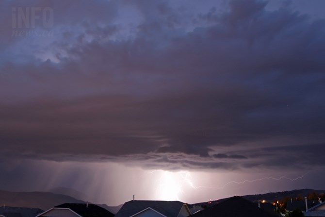
A storm rolls over the region Tuesday, May 26, causing intense lightning in the Kamloops area.
(JENNIFER STAHN / iNFOnews.ca)
June 02, 2015 - 8:37 AM
THOMPSON-OKANAGAN - We didn’t get a lot rain, and temperatures were only a bit warmer than normal, but what we did have in May was lightning, and a lot of it.
Andre Bisson with Environment Canada says more than 67,000 lightning strikes were recorded across the province in May.
“(We were) near 500 per cent higher in terms of lightning strikes for the month,” Bisson says. “(May was) very, very busy in terms of lightning strikes.”
Bisson says the above normal temperatures — by about ‘a degree and a bit’ in most areas — can be attributed to the ‘much warmer than normal’ surface temperatures of Eastern Pacific waters. The warmer water surface temperature led to a warmer winter and Bisson expects the trend to persist into the summer as well.
“(The Eastern Pacific water) influences air mass over B.C., that’s why it’s been so much warmer,” Bisson says. “I have high confidence it will be warmer than normal for the (summer) season as well.”
While there was not a lot of rain in May it was active throughout the region for thunderstorms and there were a couple of big days for rain as well. Kelowna and Penticton both received about two-thirds of the average monthly rainfall for May in just one day. The Kelowna airport received 21.5 millimetres of rain on May 17 while Penticton received 24.2 mm.
Cache Creek, Merritt and other parts of the Nicola region were hit by a severe storm on May 23. Two hours of rain led to flash flooding and a state of local emergency in Cache Creek. The province has since approved disaster financial assistance for several communities in the area.
“It only takes one big storm and you can have a lot of precipitation,” Bisson notes.
Bisson says spring precipitation in the Interior is ‘much harder to predict’ because it is driven by more localized factors but the warmer weather in the forecast could result in at least more storms.
“It’s been quite an interesting month — most of the province has been warmer (and) warm air can hold more moisture, so we had instability,” Bisson says, adding this instability will likely continue through June. “I’m expecting another busy month in terms of thunderstorm activity.”
To contact a reporter for this story, email Jennifer Stahn at jstahn@infonews.ca or call 250-819-3723. To contact an editor, email mjones@infonews.ca or call 250-718-2724.
News from © iNFOnews, 2015