(CHARLOTTE HELSTON / iNFOnews.ca)
Republished July 23, 2014 - 8:02 AM
Original Publication Date July 22, 2014 - 12:25 PM
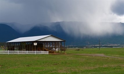
THOMPSON-OKANAGAN - As much as 50 millimetres of rain could fall over the next two days as a low pressure system moving through southern B.C. is set to produce heavy showers and thunderstorms.
Environment Canada issued a special weather statement this morning noting the potential for locally heavy rainfall of 25-50 mm with thunderstorms, which will have the potential to fall in a few hours or less. The weather service warns these rains could cause localized flooding as smaller creek systems rise rapidly.
At this point forecasters are unsure about the exact location of the thunderstorms but have issued the statement for the Shuswap, South Thompson, North Thompson and Nicola regions as well as the entire Okanagan and other parts of southern B.C. A severe thunderstorm watch is also in place for the southeastern corner of the province where conditions are 'favourable for the development of dangerous thunderstorms.'
The system, which is expected to last through Thursday, could also bring severe lightning, wind gusts and hail to all areas under the special weather statement. It is moving in from the south and may only provide a few hours notice before developing.
Temperatures will cool to as low as 20 C in the lower parts of the region as the system passes through.
To contact a reporter for this story, email Jennifer Stahn at jstahn@infonews.ca or call 250-819-3723. To contact an editor, email mjones@infonews.ca or call 250-718-2724.
— This story was updated at 7:49 a.m., July 23, with additional information from Environment Canada.
News from © iNFOnews, 2014