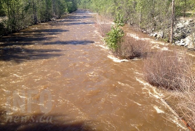
FILE PHOTO: Water is flowing quickly in Mission Creek in 2016.
(ADAM PROSKIW / iNFOnews.ca)
Republished May 05, 2017 - 3:15 PM
Original Publication Date May 05, 2017 - 11:41 AM
KELOWNA - The flood watch issued in the Okanagan and Shuswap this morning has been expanded this afternoon.
The River Forecast Centre originally issued a flood watch for Mission Creek in Kelowna and Salmon River in the Shuswap this morning, May 5, as water continues to rise.
This afternoon the Forecast Centre has added the Kettle River and the entire Shuswap region, including tributaries.
Hot weather melting the snow pack along with thunderstorms dropping up to 15 mm of rain in a short period of time in some areas overnight are blamed for the sudden floods, according to the media release.
The River Forecast Centre announced that including precipitation this afternoon some areas have gotten up to 20 mm as part of the current system and another 10 to 20 mm may fall in the Okanagan and Shuswap regions before things are done, meaning higher streamflows will likely remain or increase through the rest of today, May 5, and ease tomorrow.
Central Okanagan Emergency Operations has issued an evacuation order for Fintry Provincial Park north of Kelowna on the westside of Okanagan Lake. Campers have left the park and one residence has been evacuated. Emergency support services are in place for those effected and the organizations emergency operations centre is active, according to a media release.
Westside Road is down to alternating single lane traffic at the North Westside Fire Hall.
Other areas are also being addressed by the emergency operations, including Kelowna, West Kelowna, Ellison and the area around Short's Creek and the Fintry Delta.
Creeks and rivers in the area are expected to continue to rise today, May 5, and a high streamflow advisory has been issued for the Southern and Central Interior, including Kelowna, Penticton, Vernon, Osoyoos, Salmon Arm and Kamloops.
Because of the rising water, parks in the Central Okanagan have been affected. The regional district has closed the trail in Glen Canyon Regional Park between Brown Road and Gellatly Road, including the parking area at Gellatly Road. Gellatly Road itself has been closed in two locations as well.
The Greenway trail under the Casorso Road and Gordon Drive bridges have been closed , meaning pedestrians and cyclists will have to cross the roads. The regional district is urging motorists in that area and people crossing at the roads use caution.
The regional district is also warning boaters to watch for increased debris from creeks that empty into Okanagan Lake.
Sandbags are available at local fire halls in the Central Okanagan.
— This story was updated at 2:50 p.m. May 5, 2017 to add new information from the River Forecast Centre.
To contact a reporter for this story, email Brendan Kergin or call 250-819-6089 or email the editor. You can also submit photos, videos or news tips to the newsroom and be entered to win a monthly prize draw.
We welcome your comments and opinions on our stories but play nice. We won't censor or delete comments unless they contain off-topic statements or links, unnecessary vulgarity, false facts, spam or obviously fake profiles. If you have any concerns about what you see in comments, email the editor in the link above.
News from © iNFOnews, 2017