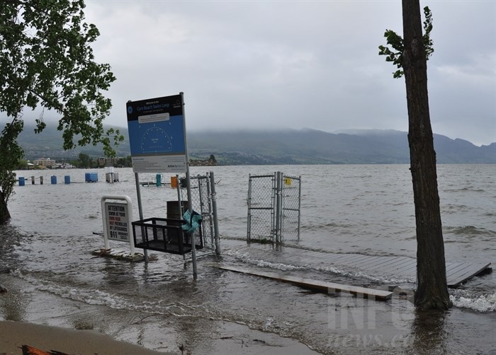
This dock isn't supposed to be in front of Gyro Beach in Kelowna. It and several other docks broke loose and have joined wood and debris washing up on the shore, Wednesday, May 24, 2017.
(MARSHALL JONES / iNFOnews.ca)
Republished May 24, 2017 - 2:38 PM
Original Publication Date May 24, 2017 - 10:06 AM
KELOWNA - The high winds produced by last night's storm that blew through the Interior left serious damage behind in the Central Okanagan.
Environment Canada predicted the northeasterly wind could reach 70 km/h overnight, and with the lake level already well above full pool, waves were expected to crest most docks. The forecasters were not far off. The top wind gust recorded in Kelowna was 74 km/h.
It was enough to down branches, break up docks and knock out power to hundreds of Southern Interior residents.
"High winds on overfilled lakes last night caused localized flooding for residences in low lying areas on Central Okanagan lakes," Central Okanagan Emergency Operations officials from say in a media release. "Emergency crews are out today clearing windfall from streams, inspecting and assessing flood protection measures and infrastructure to determine the top priorities for further action. Residents should be aware of the risk of falling trees within saturated ground conditions near lakes and creeks."
It also brought tonnes of sand on shore, creating beaches where they didn't exist before.
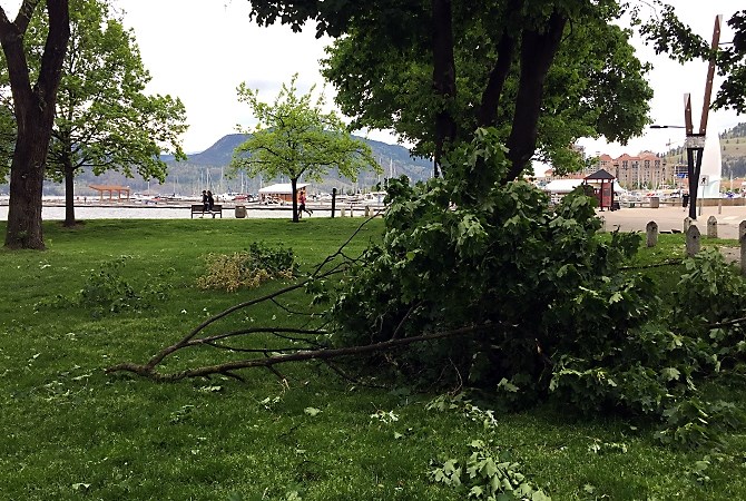
Branches in City Park in Kelowna were knocked down during the wind storm last night.
(MARSHALL JONES / iNFOnews.ca)
Okanagan Lake rose 4.5 centimetres overnight to a level of 342.95 metres, only five centimetres below the highest level of 343 metres recorded in 1948.
"A break in the weather today offers residents a chance to fortify flood protection," emergency officials say. "With lakes approaching historic volumes, the high water levels are expected to remain well into July. Residents are urged to keep protection in place for the foreseeable future."
In Penticton today, city crews are assessing the damage public lakeshore from the storm. The North Okanagan and Shuswap weren't spared, with trees uprooted and damaging wave action on area lakes.
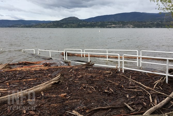
Rotary Beach received major damage last night.
(ADAM PROSKIW / iNFOnews.ca)
In the wake of the cold front that produced the stormy weather, freezing levels have dropped on mountain pass highways in the Interior, and snow is falling.
The forecast is for warmer weather to return later this week, which could accelerate the snow melt and further boost creek flows into Okanagan Lake.
Sandbagging stations are stocked and replenished daily at locations throughout the Central Okanagan. A map is available at the CORD website.
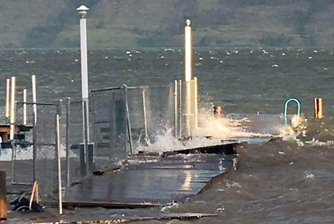
A dock at a West Kelowna mobile home park was completely destroyed during the wind storm last night, Tuesday, May 23, 217.
Image Credit: SUBMITTED
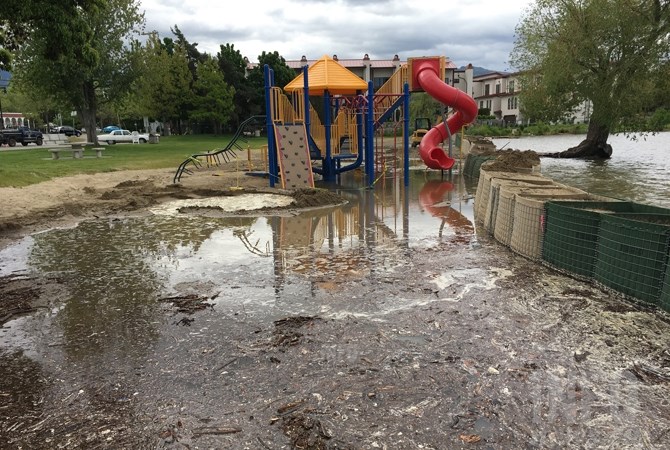
Rotary Beach is getting more sand to help prevent damage to the shore.
(ADAM PROSKIW / iNFOnews.ca)
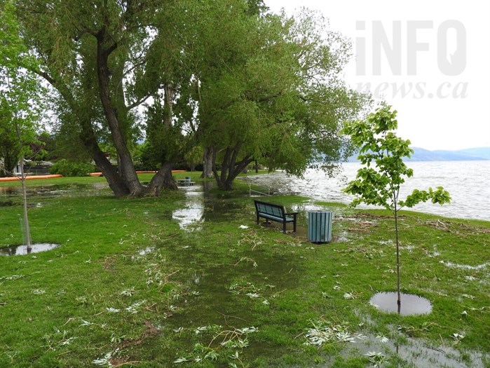
Lake water has saturated a large portion of Kinsmen Park, in Kelowna.
(JENNA HICKMAN / iNFOnews.ca)
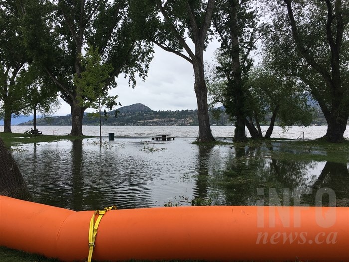
An Aqua Dam has been put in place at Kinsmen Park in order to prevent lake water from flooding the park and neighbouring areas.
(JENNA HICKMAN / iNFOnews.ca)
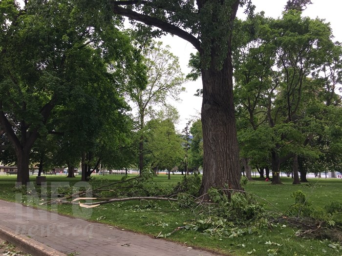
Many tree branches were broken in Tuesday night's wind storm in Kelowna where winds reached 74 km/hr. This photo was taken in Kelowna City Park.
(JENNA HICKMAN / iNFOnews.ca)
— This story was updated at 11:05 a.m. Wednesday, May 24, 2017 to correct the speed of the top wind gusts in Kelowna.
To contact a reporter for this story, email Adam Proskiw or call 250-718-0428 or email the editor. You can also submit photos, videos or news tips to the newsroom and be entered to win a monthly prize draw.
We welcome your comments and opinions on our stories but play nice. We won't censor or delete comments unless they contain off-topic statements or links, unnecessary vulgarity, false facts, spam or obviously fake profiles. If you have any concerns about what you see in comments, email the editor in the link above.
News from © iNFOnews, 2017