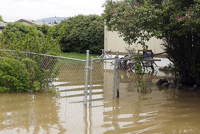
A mobile home in Lake Country May 11, 2017.
(ADAM PROSKIW / iNFOnews.ca)
May 12, 2017 - 2:30 PM
OKANAGAN – Officials monitoring the flood threat aren’t feeling any more relaxed today, May 12, just because the weather has improved.
“We haven’t even seen the water from yesterday’s thunderstorm fully make its way into the Okanagan yet,” Dave Campbell with the B.C. River Forecast Centre says. “The rivers haven’t peaked from that rainfall yet. It takes some time and it depends on the river you’re dealing with.”
Last week, a prolonged period of heavy rain paired with a sudden warming at higher elevations caused flooding across the Thompson-Okanagan.
Because the ground is already saturated by rain, and the lakes and reservoirs are full, the melting snow has nowhere to go, he says. There is still plenty of snow at the middle and higher elevations surrounding the valley.
The River Forecast Centre re-issued a flood watch this morning for the Nicola River, Salmon River, Mission Creek, Kettle River and Granby River and contined the high streamflow advisory for the Central Interior, South Interior and Southeast B.C.
Mission Creek and Mill Creek, he says, likely won't even peak from yesterday's rain until later today.
“We had a bit of rain that worked its way across the valley, some thundershowers and rain overnight but not quite as much as forecast,” Campbell says. “A lot of that has come through but a lot of the bigger rivers are still working their way down.”
Bigger rivers like Mission Creek and Mill Creek, he says, are so big they don’t reach full flow until up to 24 hours after a storm, making the threat of more flooding still a reality in the days and weeks to come.
He says the creeks that have more upland storage might take until tomorrow to peak, he says.
Environment Canada says there’s still a risk of thunderstorms today, May 12, early tonight and through tomorrow afternoon.
“Certainly the next 24 hours are going to be the most critical," Campbell says.
To contact a reporter for this story, email Adam Proskiw or call 250-718-0428 or email the editor. You can also submit photos, videos or news tips to the newsroom and be entered to win a monthly prize draw.
We welcome your comments and opinions on our stories but play nice. We won't censor or delete comments unless they contain off-topic statements or links, unnecessary vulgarity, false facts, spam or obviously fake profiles. If you have any concerns about what you see in comments, email the editor in the link above.
News from © iNFOnews, 2017