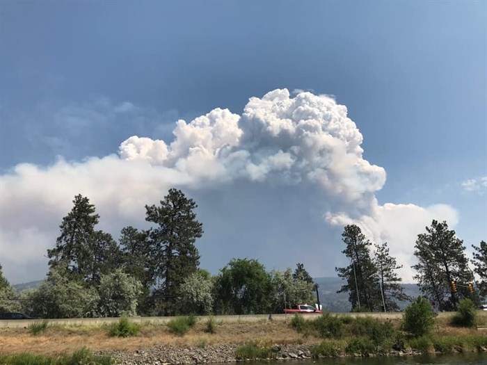
The Thomas Creek wildfire near Okanagan Falls, July 14, 2021.
Image Credit: FACEBOOK/Roderick Campbell
July 16, 2021 - 10:03 AM
A wildfire burning near Okanagan Falls is now mapped at 5,500 hectares.
The Thomas Creek wildfire, located 1.5 kilometres east of Skaha Lake, is still classified as out of control this morning, July 16.
B.C. Wildfire Service information officer Taylor MacDonald said the size increase is due to crews being able to get a better estimate on the fire's size yesterday, July 15.
"Ground personnel will continue to work on the south flank of the fire and are assisted by heavy equipment to establish and reinforce fire guards," according to the latest from the wildfire service.
The Regional District of Okanagan-Similkameen has issued an evacuation alert for 704 properties in Electoral Area D. More information on evacuation alerts can be found through the district's website.
The cause of the fire is under investigation and today, 30 firefighters, four helicopters and multiple pieces of heavy equipment are on site. Structure protection units are also on site along with the local fire department, according to the wildfire service.
To contact a reporter for this story, email Carli Berry or call 250-864-7494 or email the editor. You can also submit photos, videos or news tips to the newsroom and be entered to win a monthly prize draw.
We welcome your comments and opinions on our stories but play nice. We won't censor or delete comments unless they contain off-topic statements or links, unnecessary vulgarity, false facts, spam or obviously fake profiles. If you have any concerns about what you see in comments, email the editor in the link above.
News from © iNFOnews, 2021