
Heavy snow has been falling since daybreak in the South Okanagan this morning, Dec. 21, 2020.
(STEVE ARSTAD / iNFOnews.ca)
December 21, 2020 - 9:36 AM
Following a weekend of record setting warmth across B.C.'s southern Interior, residents should be bracing for a sudden return to winter conditions today.
High temperature records were broken in many B.C. communities yesterday, Dec. 20, but the warm conditions are being replaced by a deepening Pacific low that is crossing Washington State today.
Cold air to the north is combining with the abundant moisture in the system to produce heavy snowfall in Kamloops and the Okanagan starting this morning.
What began as rain overnight has now turned to snow in the South Okanagan this morning, as weather alerts have been issued for most of southern British Columbia.
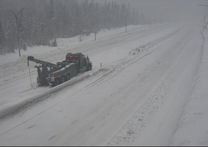
Travel advisories and snowfall warnings have been issued for most mountain highways in and out of the Thompson and Okanagan today, Dec. 21, 2020. This is the scene on the Coquihalla Highway, Zopkios northbound earlier this morning.
Image Credit: SUBMITTED / B.C. Highway Cam
Drive BC has issued a significant weather event forecast update for the southern Interior and British Columbia coast, advising of between 10 to 40 centimetres of snow in southern British Columbia, depending on location and elevation.
Drive BC has also issued a travel advisory for the Hope-Princeton Highway this morning, between Hope and Sunday Summit, advising of hazardous winter conditions and snowfall amounts up to 40 cm.
A travel advisory has also been issued for the Coquihalla Highway and the Okanagan connector.
Environment Canada has issued snowfall warnings for Kamloops and all three major Okanagan cities this morning.
Between 12 and 14 cm of snow is expected in Kamloops, while Vernon could see between 10 and 20 cm over today and tonight.
Kelowna could see between 7 and 14 cm while Penticton and area could see between 7 and 20 cm by midnight tonight.
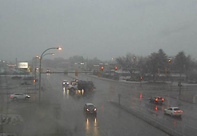
Kelowna is expected to recieve between 7 and 14 cm of snow today. This is the scene at Highway 97 and Highway 33 earlier this morning, Dec. 21, 2020.
Image Credit: SUBMITTED / B.C. Highway Cam
Weather alerts have been issued for most mountain highways, including the Coquihalla Highway from Hope to Merritt, Merritt to Kamloops and the Okanagan Connector from Merritt to Kelowna.
A weather alert has also been issued for the Trans Canada Highway from Eagle Pass to Rogers Pass and from Highway 3, Hope to Princeton and Highway 3, Paulson Summit to Kootenay Pass.
To contact a reporter for this story, email Steve Arstad or call 250-488-3065 or email the editor. You can also submit photos, videos or news tips to tips@infonews.ca and be entered to win a monthly prize draw.
We welcome your comments and opinions on our stories but play nice. We won't censor or delete comments unless they contain off-topic statements or links, unnecessary vulgarity, false facts, spam or obviously fake profiles. If you have any concerns about what you see in comments, email the editor in the link above.
News from © iNFOnews, 2020