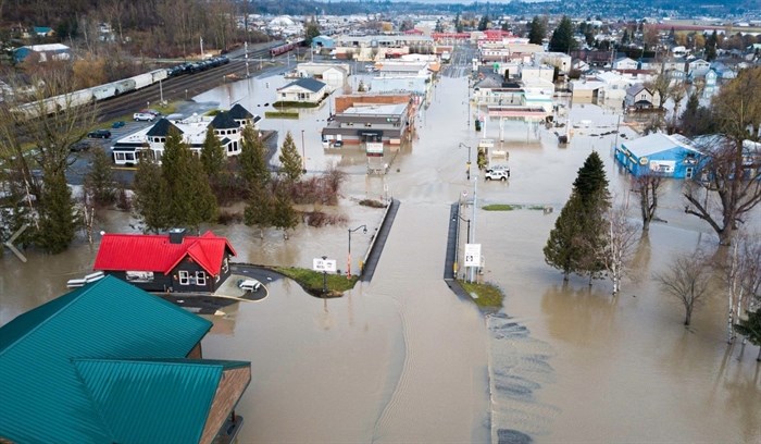
The new atmospheric river is expected to start dumping rain on the Sumas Prairie tonight.
Image Credit: FACEBOOK/Northwest digital imagery
November 29, 2021 - 1:07 PM
The latest atmospheric river is expected to dump another 25 to 75 millimetres of rain in the water-soaked Fraser Valley starting tonight and into Wednesday.
It may release most of its moisture on the coastal side of the mountains before reaching the Thompson-Okanagan.
“You’ll see a little bit of rain through tomorrow into Wednesday but no more than 10 mm, maybe 15 mm,” Brett Anderson, senior meteorologist with AccuWeather, told iNFOnews.ca today, Nov. 19.
The storm hitting the Lower Mainland may dump 125 to 175 mm on the west coast of Vancouver Island and some mountainous areas of the mainland but isn’t likely to be as bad as the Nov. 15 storm that closed all highways into the Lower Mainland, caused extensive flooding in Sumas Prairie and forced the evacuation of Merritt and Princeton.
READ MORE: The latest on flooding, recovery in B.C. on Nov. 26
“I don’t think this one is that bad but it’s bad enough, and obviously when we’ve had all this rain, the ground is completely saturated, the rivers and streams are still flooding,” Anderson said. “If it was just its own event and we hadn’t had all these other events previous, it would still cause flooding. But now, when you’ve had all these events, it’s just going to make things worse.”
It’s also coming with warm temperatures so will melt snow in the mountains which will run into already streams and rivers already flowing at high levels.
The B.C. River Forecast Centre issued warnings today for coastal areas and upgraded a flood watch for the Tulameen, Coldwater and Nicolas Rivers to a flood warning. The flood watch on the Similkamen River has been maintained.
In the southeast, the river forecast centre has issued or maintained high streamflow advisories for the Upper Columbia region including Revelstoke and Golden and the surrounding areas including lower elevation and valley bottom tributaries including the Elk, Duncan and St. Mary Rivers.
There will be a break from the rain after Wednesday but the next storm looks to be moving in as early as Sunday.
Tonight’s atmospheric river and the ones before it have come from the north and west of Hawaii so have been quite warm. The next one is coming from east of Hawaii so will be colder and could bring snow into the Thompson and Okanagan regions.
READ MORE: Storm warnings continue for Interior highways as roads remain closed
The forecast for the region calls for highs up to 9 Celsius early in the week and sunny skies Thursday and Friday with overnight lows down to -4 C later in the week.
The storms so far have hammered B.C. and the northwest of Washington state, north of Seattle. The next system may be a little further south into Washington state, Anderson said.
To contact a reporter for this story, email Rob Munro or call 250-808-0143 or email the editor. You can also submit photos, videos or news tips to the newsroom and be entered to win a monthly prize draw.
We welcome your comments and opinions on our stories but play nice. We won't censor or delete comments unless they contain off-topic statements or links, unnecessary vulgarity, false facts, spam or obviously fake profiles. If you have any concerns about what you see in comments, email the editor in the link above.
News from © iNFOnews, 2021