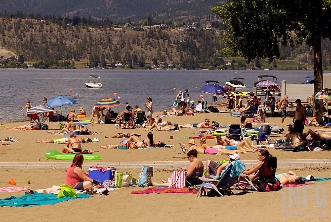
This weekend could see record weather.
(ADAM PROSKIW / iNFOnews.ca)
June 23, 2021 - 7:00 AM
Temperature records are poised to topple across B.C. as the heatwave that gripped the Lower Mainland settles deeper into the Interior.
“What we’ve experienced already is pretty impressive heat, of course, and there have been daily temperature records broken in the last few days,” Armel Castellan with Environment and Climate Change Canada said.
“And today what’s interesting on the Coast is we are getting a bit of marine reprieve. The Pacific Ocean is a natural air conditioner if you will, and it’s dropping temperatures to seasonal averages but for the Thompson and Okanagan you’re not even missing a beat.”
Castellan said on Wednesday and Thursday there will be a bit of cloud but the main event is a “skull-crushing ridge” so strong that it’s going to start feeling like the middle of July, rather than the end of June.
“From Friday, but particularly Saturday and Sunday, there will be extreme heat,” he said.
Daily records will likely break, but it’s also expected that all-time records could fall.
In Kamloops, for example, the all-time record is 41.7 C and the city will definitely be in that territory, if not beyond.
“This is fairly abnormal,” he said. “Usually June is the month we get cold lows that stick around and we get a few days of rain, and then a reprieve before the hottest days of the year,” he said. “If we don’t get it in June and we’re in a July pattern now, that sets the stage for what is potentially problematic.”
It’s particularly worrisome given that this has been a record-breaking dry spring in Victoria, Vernon and Kelowna.
Between the potential for lightning storms and human error, the risk for wildfires at this moment seems particularly high, which B.C. Wildfire has said in its summer projection.
That said, weather prognosticators have said that before and been wrong. In 2019, June was very similar and then an “amazing number of storms” rolled in and put a damper on summer.
“That could still happen this July, we don’t have precipitation models to talk about what mid-July will be like,” he said.
What is clear, however, is that climatologically speaking, mid-July to mid-August are the least likely to see a lot of rain.
As for why and how it’s not exactly a new story.
“Climate change is affecting temperatures… these events in and of themselves are part of a pattern that’s going to happen,” Castellan said. “Would we have 40 C days in Kamloops without it? Maybe just not with the same intensity but also the frequency.”
This heatwave and others that follow will have implications on populations and, in turn, local governments will have to look at ways to mitigate the attached risk for their populations.
And, if you’re able, there’s one really good way to beat the heat.
The Environment Canada water office keeps track of water temperatures and as of this Tuesday afternoon, it pegged Okanagan Lake at 19.65 C, up from 17 C just a couple of days earlier.
Interior Health offered up some warnings as the heat ramped up. They pointed out that excessive heat exposure can lead to weakness, disorientation and exhaustion. In severe cases, it can also lead to heat stroke, also known as sunstroke. Heat stroke can be a life-threatening medical emergency, the health authority said.
Who is most at risk?
Anyone can suffer from heat-related illness, but some people are at greater risk. Take extra care to check on the following people regularly:
-
Infants and young children, who rely on adults to monitor their environments and to provide them with enough fluid to drink;
-
People 65 years or older, or anyone who needs assistance monitoring their wellbeing;
-
People with heart problems and breathing difficulties;
-
People who exercise or who work outside or in a hot environment.
The symptoms of heat-related illness can range from mild to severe. They include:
-
Pale, cool, moist skin
-
Heavy sweating
-
Muscle cramps
-
Rash
-
Swelling, especially hands and feet
-
Fatigue and weakness
-
Lightheadedness and/or fainting
-
Headache
-
Nausea and/or vomiting
More severe symptoms – including high fever, hallucinations, seizures and unconsciousness – require urgent medical attention. Call 911, move to a cool place, and cool the person with water and fanning.
They recommend to plan your outdoor activity before 11 a.m. or after 4 p.m., to avoid the most intense sun.
To contact a reporter for this story, email Kathy Michaels or call 250-718-0428 or email the editor. You can also submit photos, videos or news tips to the newsroom and be entered to win a monthly prize draw.
We welcome your comments and opinions on our stories but play nice. We won't censor or delete comments unless they contain off-topic statements or links, unnecessary vulgarity, false facts, spam or obviously fake profiles. If you have any concerns about what you see in comments, email the editor in the link above.
News from © iNFOnews, 2021