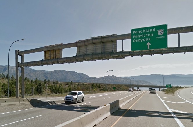
Image Credit: Google Street View
Republished July 29, 2019 - 3:55 PM
Original Publication Date July 29, 2019 - 3:17 PM
PEACHLAND - Changes to Highway 97 through Peachland may be decades in the offing, but they're already causing conflict.
The province today, July 29, released three preferred route options aimed at improving safety and travel times along the Highway 97 corridor. Two of the options bypass the city, and one looks at increasing the flow of traffic through the current highway. There were more options initially discussed, but some have been ruled out for complexity or cost, or a combination of both factors.
To get this far in the process, the province looked at current and projected conditions on the Highway 97 corridor, considered demographics, community plans and regional transportation needs as part of the identification of the ultimate long-term solution for the highway.
Now they are entering their second phase of the process, which is expected to be completed in spring 2020. It will require further engagement with community members, stakeholders and local and Indigenous governments.
Once all that is said and done, the future corridor will be decided upon.
While the options were just released, council for the District of Peachland has already had a look and say that they oppose the preferred alternate and existing Highway 97 transportation options presented by the Ministry of Transportation.
“Neither option has addressed the valid concerns of the community, and the technical options failed to give enough weight to the social and community impacts of the on-line or off-line routes,” said Mayor Cindy Fortin, in a press release about the three options presented.
“The alternate or bypass routes are definitely not what the community envisioned. To be blunt, it is very disappointing."
Fortin said the proposed off-line routes do not bypass the community at all. In fact, they split the community in two. This, she said, is unacceptable and one of the earlier options would have been a better choice.
As the only north-south link connecting Okanagan communities, Highway 97 is vital to the region’s economy. The segment through Peachland is the last remaining two-lane highway between Penticton and Vernon.
The need for changes to the route has come to the fore following the Central Okanagan's economic and population growth, which has been accompanied by increasing highway traffic volumes.
The ministry maintains a permanent count station on Highway 97 south of Highway 97C. Traffic volumes have gradually increased in recent years, from slightly over 15,000 vehicles daily south of Drought Hill in 2006, to approximately 17,700 in 2013.
This increase in daily traffic translates into an average annual growth rate of approximately 2.2 per cent from 2006 to 2013.
To read the full report go here.
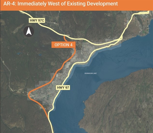
One of the routes discussed by the Ministry of Transportation.
Image Credit: SUBMITTED/Ministry of Transportation
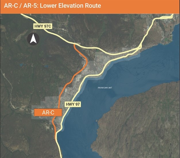
This is a lower elevation route proposed by the Ministry of Transportation.
Image Credit: SUBMITTED/Ministry of Transportation
To contact a reporter for this story, email Kathy Michaels or call 250-718-0428 or email the editor. You can also submit photos, videos or news tips to the newsroom and be entered to win a monthly prize draw.
We welcome your comments and opinions on our stories but play nice. We won't censor or delete comments unless they contain off-topic statements or links, unnecessary vulgarity, false facts, spam or obviously fake profiles. If you have any concerns about what you see in comments, email the editor in the link above.
News from © iNFOnews, 2019