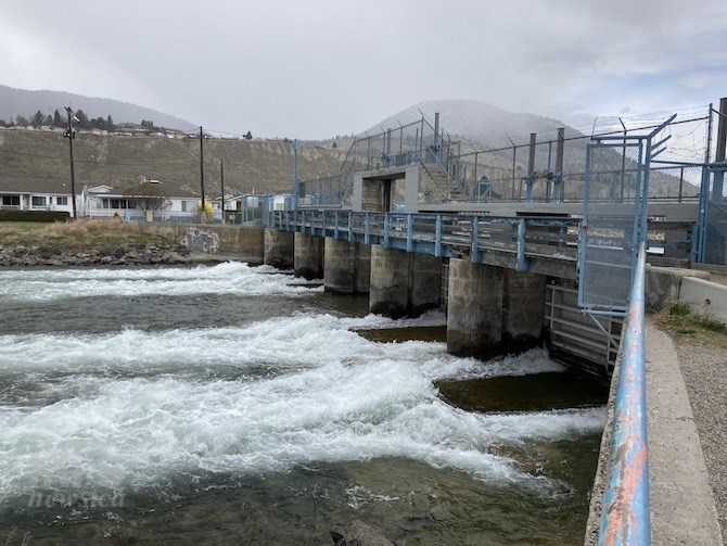
Water discharging from the dam on Okanagan Lake in Penticton in late April. Two months of drier and warmer weather has reduced the forecast for water flow into Okanagan Lake in the coming weeks.
(STEVE ARSTAD / iNFOnews.ca)
May 07, 2021 - 6:00 PM
The last two months of drier and warmer weather in B.C.'s Southern Interior of British Columbia have had a big impact on water flow rates into Okanagan Lake, and the possibility of flooding this year.
Okanagan Lake dam operator Shaun Reimer said inflow forecasts for water heading into Okanagan Lake have changed “dramatically” in the past month.
“Clearly, we started the year with above average snowpacks, but the dry weather we’ve had as the season has progressed has chipped away at that," Reimer said today, May 7, as the latest snowpack measurements were released by the B.C. River Forecast Centre.
"Inflow projections dropped off as the season has progressed... pretty much through April we had an above average inflow forecast, but now, all of a sudden, we are below.”
Reimer said new inflow models suggest Okanagan Lake could see between 65 and 78 per cent of normal flow over the coming months.
“We are transitioning into a year where we are going to be concerned about water supply more than flooding,” Reimer said.
Okanagan Lake is currently more than 70 centimetres below full pool. Reimer said it is unlikely the lake will reach full pool this year, but could end up within 30 cm of full pool, normally considered at 342.8 metres.
“I’ll probably be backing off on outflow rates at the Okanagan Lake dam in Penticton, with minimal outflows likely by summer, unless things change,” Reimer said.
There was an expectation at the start of this past winter of a La Niña year that conditions would be colder and wetter, but for the most part that hasn’t transpired. Since February, the Thompson and Okanagan has been exceptionally dry.
“Last year we had lots of rain in the valley by this time. The best case scenario now would be to have a healthy amount of rain in June when the high elevation snow has less impact, but we still get the kind of rain that will dampen fire activity,” Reimer says.
The latest data from the River Forecast Centre reports snowpack provincewide declined from an average 113 per cent to 106 per cent through April.
Locally, the Okanagan was down to 91 per cent from 109 per cent at the beginning of April, while the Lower Thompson declined from 122 per cent to 77 per cent. The North Thompson declined from 103 per cent to 99 per cent and the South Thompson from 100 per cent to 80 per cent. The Similkameen saw a reduction from 112 per cent to 110 per cent.
The River Forecast Centre says the Southern Interior could still see flooding through a combination of rapid snowmelt and rainfall, or through intense rainfall alone.
To contact a reporter for this story, email Steve Arstad or call 250-488-3065 or email the editor. You can also submit photos, videos or news tips to tips@infonews.ca and be entered to win a monthly prize draw.
We welcome your comments and opinions on our stories but play nice. We won't censor or delete comments unless they contain off-topic statements or links, unnecessary vulgarity, false facts, spam or obviously fake profiles. If you have any concerns about what you see in comments, email the editor in the link above.
News from © iNFOnews, 2021