
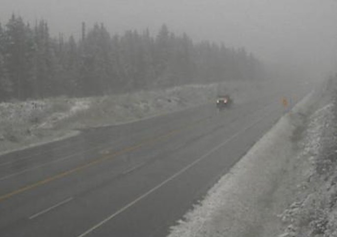
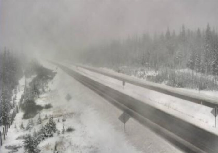
Fog along with the fresh snow is making driving a challenge, Tuesday, Oct. 13, 2020 through Rogers Pass on the Trans-Canada Highway. Here's the view from the Drive B.C. webcam looking east.
Image Credit: DriveBC
October 13, 2020 - 12:25 PM
The first major snowfall of the season on the upper elevation mountain passes in the southern Interior of B.C. is making driving a challenge for those heading home after the Thanksgiving long weekend.
The snow started to fall on Sunday, continued through the night and into this morning, Oct. 13, prompting Environment Canada to continue snowfall warnings and special weather statements giving the driving public a heads up about the slippery conditions on the region's highways.
A frontal system passing through southern B.C. is to blame for the moisture.
A snowfall warning remains in effect for the Okanagan Connector from Kelowna to Merritt and the Trans-Canada Highway from Rogers Pass to Eagle pass with between 15 and 20 centimetres of snow expected today. It should taper off in the afternoon.
Meanwhile, a special weather statement has been continued for the Coquihalla Highway from Kamloops through Merritt to Hope as snow continues on the mountain passes this morning.
For the latest on public weather warning and alerts, go to the Environment Canada website here.
For the latest on highway conditions go to the Drive B.C. website here.
Stoked about skiing? Us too! Snow fall at higher elevations and dropping temperatures are sure signs that winter is...
Posted by Vernon North Okanagan RCMP on Tuesday, October 13, 2020
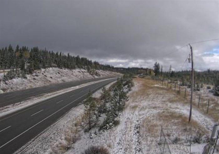
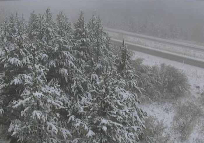
The Drive B.C. webcam view on Highway 1 near Quartz Creek around 40 kilometres west of Golden looking east.
Image Credit: DriveBC
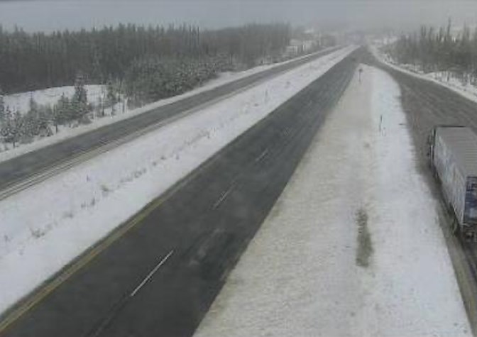
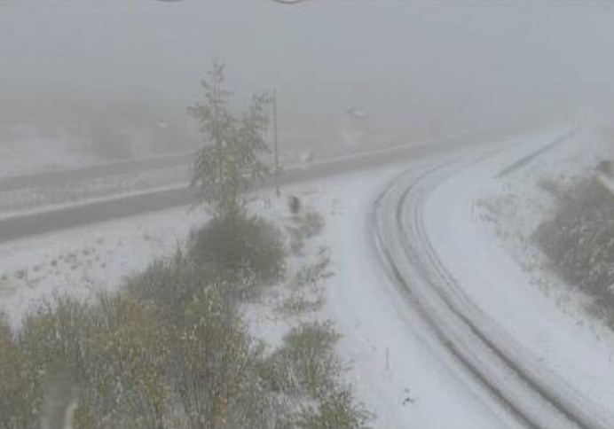
The Drive B.C. webcam view on Highway 5 at Walloper around 30 kilometres south of Kamloops looking north.
Image Credit: DriveBC
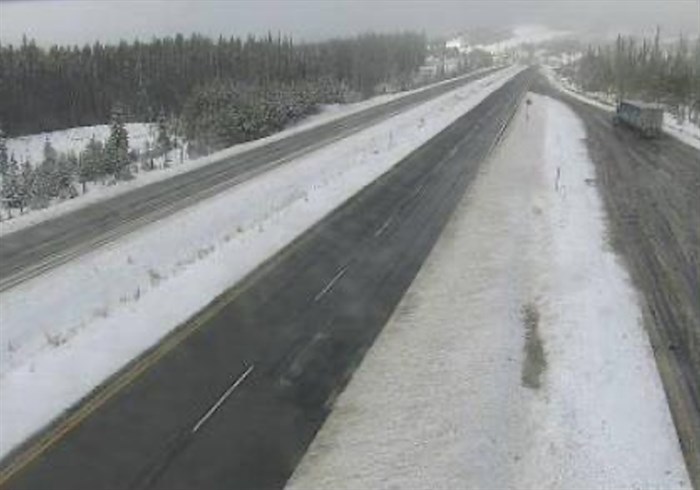
The Drive B.C. webcam view on Highway 97C about 25 kim east of the junction with Highway 5A looking west.
Image Credit: DriveBC
The Drive B.C. webcam view on Highway 97C at Elkhart looking west.
Image Credit: DriveBC
The Drive B.C. webcam view on Highway 97C at the Pennask Summit around 74 km west of Kelowna looking east.
Image Credit: DriveBC
The Drive B.C. webcam view on Highway 97C at Brenda Mine looking west.
Image Credit: DriveBC
The Drive B.C. webcam view on Highway 97C at Brenda Mine looking east.
Image Credit: DriveBC
To contact a reporter for this story, email Howard Alexander or call 250-309-5343 or email the editor. You can also submit photos, videos or news tips to the newsroom and be entered to win a monthly prize draw.
We welcome your comments and opinions on our stories but play nice. We won't censor or delete comments unless they contain off-topic statements or links, unnecessary vulgarity, false facts, spam or obviously fake profiles. If you have any concerns about what you see in comments, email the editor in the link above.
News from © iNFOnews, 2020