
Midwest storms bring heavy snow to Casper, Wyoming. October 4, 2013.
Image Credit: Porfirio Gonzalez via Instagram
October 05, 2013 - 7:34 PM
PIERRE, S.D. - Breaking nearly century-old early autumn snowfall records, a storm system smothered South Dakota's scenic Black Hills in South Dakota with up to three and a half feet of wet, heavy snow, leaving residents the challenge of digging out.
But wintry weather wasn't the only thing delivered by the powerful cold front that crossed the Great Plains, as unusually strong thunderstorms brought heavy rain, hail and as many as nine tornadoes to Nebraska and Iowa. Fifteen people in northeast Nebraska were injured in a tornado Friday, while three died in a car accident on a snow-slicked road.
Forecasters said the front would eventually combine with other storms to make for a wild — and probably very wet — weekend for much of the central U.S. and Southeast.
Power outages and impassable roads plagued western South Dakota on Saturday. More than 25,000 people had lost power in the Black Hills area, and authorities were recruiting snowmobilers to help rescue about 80 motorists who'd been stuck overnight.
Video: Reuters' Deborah Lutterbeck reports
Rapid City plow driver Jesse Curnow said Saturday morning things weren't moving so smoothly in chest-high drifts after a record 21-inch snowfall. He couldn't get out of the business' parking lot.
"I'm trapped. I can kind of move, but only a little bit," Curnow said by telephone from the cab of his truck.
Pennington County Emergency Management spokeswoman Alexa White said rescue efforts were slow-going, because "the only way to get there is the snowmobiles or the Sno-Cats."
"The plows have gotten stuck in the roads," she said.
Also stuck were four employees of the National Weather Service's Rapid City office. They'd been there since Friday, meteorologist David Carpenter said Saturday.
"There is a 3-foot drift across the parking lot and no one has had the energy to shovel it out yet," he said.
Friday's snowfall — 19 inches — broke the previous one-day snowfall record for October by about nine inches; it was set on Oct. 19, 1919, Carpenter said. Rapid City saw an extra 2.5 inches overnight. Friday also surpassed the record for the entire month, 15.1 inches, also set in 1919.
National Weather Service meteorologist Katie Pojorlie said Lead, S.D., in the northern Black Hills had received 43 1/2 inches of snow by 7:30 p.m. Friday and more had fallen overnight.
That's not unheard of in the area, according to Donna Heaton, manager of the Terry Peak Lodge.
"Last year in April, we got over 50 inches after the ski area closed. It would be nice to help the local economy if all the snow would fall when the ski area and the snowmobile trails were open," she told AP radio.
And in southwest North Dakota, about 10 inches of snow fell Friday, the National Weather Service said.
Interstate 90 was still closed in the western part of South Dakota on Saturday, and officials advised against travel elsewhere as white-out conditions kept snowplows from making much progress on roads until at least late in the day.
"... There's no place to go even if you do get your of your driveway and onto your street," state Transportation Secretary Darin Bergquist said in a statement.
Crews with Black Hills Power weren't able to work overnight because of blowing snow, spokesman Mutch Usera said. The Black Hills' rough terrain and downed tree branches were also hampering restoration efforts, he said.
"Hopefully, the sun will shine a little bit and get a bit warmer. That's going to make it easier," Usera said.
When temperatures warm up into the 50s by Monday, the snow melt could cause flooding, White said, but officials are just focusing on rescue efforts for now.

Traci Krus looks at a pictures of her family that she found in her damaged home.
Image Credit: AP Photo/Dave Weaver
Meanwhile, National Weather Service meteorologist Mike Fuhs said as many as nine tornadoes touched down in Iowa and Nebraska between 6 p.m. and 7:45 p.m. Friday. He called some of them "quite powerful," and noted it was unusual to see so many and with such power during the fall.
Some of the most severe tornado damage was in Wayne, Neb., where at least 10 buildings were destroyed and five were heavily damaged, the Omaha World-Herald reported. Video showed a farm implement showroom and a grain elevator had been destroyed. Mayor Ken Chamberlain said at least 15 people were injured, with one person in critical condition.
In northwest Iowa, nearly two dozen farmsteads were destroyed and 60 damaged, said Woodbury County Emergency Director Gary Brown. He said the storms cut a 35-mile-long path through the county, but there was only one report of a minor injury.
The cold front is moving slowly east and expanding south and will meet up with the remnants of Tropical Storm Karen. Pojorlie noted that the wet, heavy snow was more typical of a spring storm.
"Normally, we get some snow events here in October that give people a little bit of a chance to learn how to drive in snow again," she said. "This year, we got started with a blizzard."
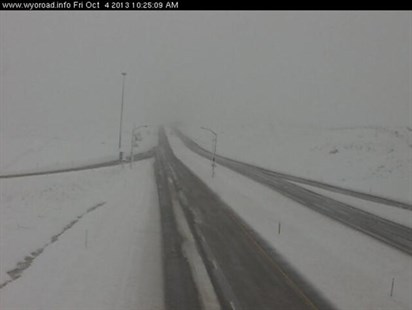
Traffic cam image from I-90 in Wyoming. Midwest storms bring heavy snow to the midwest.
Image Credit: State of Wyoming
___
Associated Press writers Margery Beck in Omaha, Neb.; Ed Donahue in Washington, D.C.; Dirk Lammers in Sioux Falls, S.D.; James MacPherson in Bismarck, N.D., contributed to this report.
News from © The Associated Press, 2013