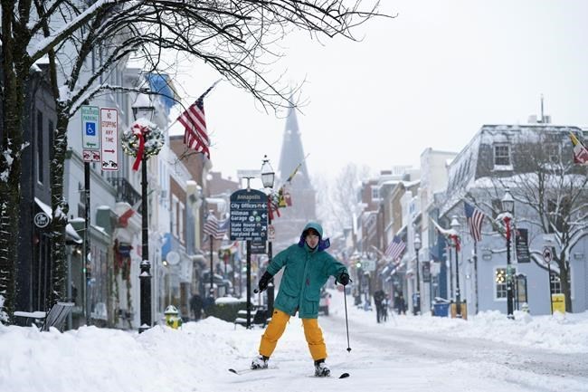
FILE - Cosimos Cendo, of Washington, D.C., skis down Main Street in Annapolis, Md., Monday, Jan. 6, 2025, during a snow storm. (AP Photo/Susan Walsh, File)
January 07, 2025 - 4:42 AM
Frigid air that normally stays trapped in the Arctic has escaped, plunging deep into the United States for an extended visit that is expected to provoke teeth-chattering but not be record-shattering.
It's a cold air outbreak that some experts say is happening more frequently, and paradoxically, because of a warming world. Such cold air blasts have become known as the polar vortex. It's a long-established weather term that's become mainstream as its technical meaning changed a bit on the way.
What it really means to average Americans in areas where the cold air comes: brrrrr.
What's happening is the jet stream — that usually west-to-east river of air way above ground that moves weather systems along — has made a roller-coaster like dip from the Pacific Northwest to the Southeast and is stuck on that wavy track. To the west of that plunge, in California, it's hot and dry. But to the east and just above the dip, it's a taste of the North Pole.
“We're just getting a lot of cold Canadian and Arctic air that's being just channeled from north to south,” said Dan DePodwin, AccuWeather director of forecast operations. “We really expect this to be more of a prolonged stretch of well below historical average temperatures. We're talking 12 to 25 degrees Fahrenheit (7 to 14 degrees Celsius) across a large portion of the eastern half of the country.”
The worst will be in areas that just got hit with heavy snow, from Kansas to Washington, said National Weather Service Weather Prediction Center meteorologist Zack Taylor: “That's where we could see actual overnight lows down well into the single digits, perhaps even below zero in some places across the Ohio Valley and the Plains.”
Judah Cohen, seasonal forecast director at the private firm Atmospheric and Environmental Research, called this a polar vortex event. He and DePodwin called it a stretching of the polar vortex, which is cold air normally penned in high above the Arctic that's there year round.
“Think of it as like a rubber band at rest, kind of roundish,” Cohen said. “If you start pulling on it, it gets elongated like a hot dog or like pulling on a rubber band. It gets stretched out.”
When the polar vortex stretches it can either bring that cold air south to the United States or toward Asia, said Cohen, an expert in winter weather.
Other times, when something called sudden stratospheric warming happens, the polar vortex moves away from the Arctic and comes south or even splits. That's not the case this time, Cohen said.
Other meteorologists, including Yale Climate Connections' Jeff Masters, along with National Weather Service Climate Prediction Center meteorologist Laura Ciasto, who co-writes the agency's “polar vortex blog, " say the polar vortex term is being misused. Technically, the polar vortex is 20 miles high in the stratosphere. And what's happening right now is down lower.
These type of polar vortex disruptions — stretching or moving entirely out of the North Pole — are happening more frequently, according to a study last month by Cohen, Woodwell Climate Research Center scientist Jennifer Francis and others.
“There's a climate change signal in that,” Francis said.
The Arctic is warming four times faster than the rest of the world, which means the difference between temperatures up north and down south are shrinking, Francis said. Arctic sea ice is shrinking, especially near the Barents Sea in Scandinavia, which releases more heat into atmosphere. That means more energy bouncing off and warping or moving the polar vortex, Cohen said.
DePodwin, who was not part of the study, said that makes sense because of these changes in the Arctic “the jet stream seems like in a warming world may be more amplified.”
Yet winters globally are on average 1.1 degrees Fahrenheit (0.6 degrees Celsius) warmer than 25 years ago, according to National Oceanic and Atmospheric Administration data. There can be more more cold outbreaks and warmer winters at the same time, DePodwin said.
“Keep in mind that this is a small part of the whole climate, a couple of weeks of weather in a small part of the Northern Hemisphere,” DePodwin said, noting that climate change is years and decades across the globe. “Climate change does not mean that we will expect to see no more cold weather. It just means that the average temperature overall is going up and we still expect to see colder shots.”
___
Read more of AP’s climate coverage at http://www.apnews.com/climate-and-environment
___
Follow Seth Borenstein on X at @borenbears
_____
The Associated Press’ climate and environmental coverage receives financial support from multiple private foundations. AP is solely responsible for all content. Find AP’s standards for working with philanthropies, a list of supporters and funded coverage areas at AP.org.
News from © The Associated Press, 2025