(JENNIFER STAHN / iNFOnews.ca)
December 23, 2014 - 8:25 AM
THOMPSON-OKANAGAN - You would expect that temperature would play a big part in a list of top weather stories, but unlike in previous years Environment Canada says our long, cold winter was the attention grabber in 2014.
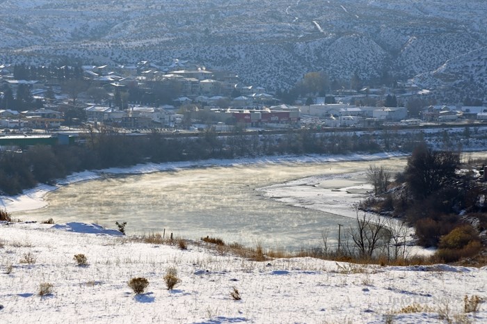
It was such a cold winter that much of the country remained cooler than usual throughout the summer as well. here in B.C. we were lucky enough to have the third hottest summer in 67 years and one of the top-ten driest summers too. This led to some large, intense wildfires, which also made the weather office top weather stories of 2014.
In B.C. our weather made it to the number one, three, five and eight spots on the top-ten list, as well as the number five spot on the runner-up list. With many records set this year, the Southern Interior was part of many of these stories.
Canada’s long cold winter
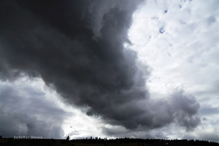
Following several mild winters, Canada’s reputation as the second coldest country next to Russia was reaffirmed in winter 2013-14. For millions of Canadians from Windsor to Quebec City, the “normal” winter period from December to February was the eighth coldest ever recorded. Even more revealing, the five months between November and March inclusive were the coldest since the start of national record-keeping in 1948.
The Southern Interior was also hit with the extreme cold weather, but not everyone was upset. A group of climbers enjoyed the rare ice formations on Highway 97 near Armstrong.
A lack of cloud cover combined with dry air kept us so cold in the Interior last winter.
(JENNIFER STAHN / iNFOnews.ca)
Summer flooding in the eastern Prairies
Water problems prevailed across the eastern Prairies just a week before summer began. Excessive rains on soggy ground − too much rain too fast over too many days – led to yet another year with huge flooding.
Wildfires in the west and northwest
Even with parts of Canada being, at times, soaked by heavy rains or underwater from floods, the Northwest Territories and British Columbia made up for it all with exceptional warmth and dryness that brought sparks to infernos in no time flat.
In British Columbia, an overheated wildfire season scorched the third-biggest loss of timber in the province since authorities began recording wildfire statistics more than 60 years ago. Fires burned more than 338,000 hectares through the province – seven and a half times the normal area charred on average over 20 years. The province more than quadrupled its firefighting budget, spending $266 million and nearly 400 firefighters from Ontario, the Maritimes, Alaska and even Australia pitched in to help..
The fire at Smith Creek, west of Kelowna, forced 2,500 people out of their homes. Over the course of the summer a series of smoke advisories and special air quality statements, issued by the province and Environment Canada respectively, were put in place for many regions, including the Southern Interior were urged to keep small children, the elderly and pets inside. On occasion, even Vancouver and the Fraser Valley were subject to air quality advisories as smoke plumes hung heavy over the skies.
Fortunately, timely rains and cool temperatures from September through October saved British Columbia from a second disastrous forest fire season and brought much-needed moisture to the somewhat water-starved province.
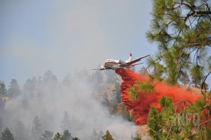
An air tanker drops retardant on a fire in West Kelowna this summer.
(MARSHALL JONES / iNFOnews.ca)
The nightmare before, during and after Christmas
The weekend before Christmas 2013 a vigorous winter storm coated parts of eastern Canada with a thick cocktail of snow, ice pellets, rain and freezing rain that plunged large parts of the region into days of cold and darkness.
Summer – hot on the coasts, cool in the centre
The summer was 1 Celsius above average making it the sixth warmest since nationwide record-keeping began in 1948. Much of Canada registered warmer than normal temperatures, with five regions (including the Southern Interior) experiencing their top ten warmest on record. The exception was Southern portions of Ontario and Quebec where, ironically, a large percentage of Canadians live. But even there temperatures were only 0.2 C below seasonal values.
The Pacific coast featured its third warmest summer in 67 years and the warmest in 10 years at 1.4 C above normal. Besides being spectacularly warm, it was remarkably dry − the seventh driest – with total rainfall 26 per cent below normal and drier than any previous summer that was warmer. The combination of heat and dry made it arguably the most delightful summer on record.
In mid-July, Interior locations experienced several days above 40 C. The hot spot was Ashcroft at 41.3 C.
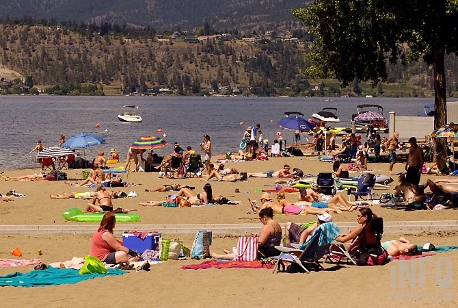
Kelowna saw record-breaking heat this summer.
(ADAM PROSKIW / iNFOnews.ca)
Hurricane Arthur and others
The season’s first hurricane, Arthur, came relatively early for a significant hurricane, while Gonzalo, the last hurricane, marked an early end to the season. Both storms were the most punishing ones of 2014 in Atlantic Canada.
Airdrie to Calgary hailer
The Prairies were hit harder by hail than any other severe weather this past summer with the biggest wallop on Aug. 8.
Powerful December storms on west and east coasts
During the second week of December, millions of Canadians from the West Coast, Central Canada and the Maritimes were bombarded by intense pre-winter storms featuring strong winds, drenching rains, flooding and heavy snowfalls.
On the West Coast, a succession of three storms from tropical origins hammered Vancouver Island and mainland British Columbia’s central and south coasts with hardly a lull between them. The combination of strong winds between 90 to 110 km/h and more than a month’s worth of soaking rains led to flash floods, pooling water on roads, washouts near rivers, and slides of mud and rock. The weather led to cancelled ferry sailings on several routes, downed trees, power outages for thousands of homeowners and businesses, and flooded streets and basements everywhere.
Angus tornado
An Enhanced Fujita Scale 2 tornado struck Angus, Ontario just before the dinner hour on June 17, with winds damaging up to 100 homes.
“Snowtember” in Calgary
Snow in September is not rare in Calgary but even longtime Calgarians were shocked when – in the midst of a sunny 25°C afternoon – they learned the next day’s forecast called for freezing temperatures and upwards of 10 cm of snow.
RUNNERS UP
Early January storm cripples Atlantic Canada
In a winter that was technically just beginning but had already worn out its welcome, there came a powerful Cape Cod storm the day after New Year’s that inflicted a crippling blow to Atlantic Canada.
Severe ice and higher, colder waters on the Great Lakes
With an early onset to winter and the intensity of the cold throughout, it was no surprise that the Great Lakes ice cover in 2013-14 was thick, expansive and lasted well into spring.
The return of sea ice
After several years of lower-than-average sea ice concentrations along the East coast, the ice was back in a huge way in 2014 as it jammed into the Strait of Belle Isle and extended southward all the way to the mouth of the St. Lawrence River and along Maritime coastlines.
Flooding from east to west
In early April, mounds of snow were beginning to melt rapidly, temperatures were rising and rain was on the way, causing major concerns about potential flooding across the Maritimes.
Then there was Alberta. With the one-year anniversary of the province’s “flood of floods” just days away, a slow-moving storm on June 17 brought fears of déjà-vu as soaking rains hit portions of southern Alberta.
Wicked winds across the west
Riding a fast-moving air stream from the Mackenzie Valley, warm Pacific winds pushed across the Prairie provinces in mid-January. The super-charged ‘breeze’ was a welcome respite to what was becoming an extremely cold winter. The strong winds brought warm temperatures and dozens of warm temperature records fell, including ones in Edmonton, Kelowna, Saskatoon and Winnipeg.
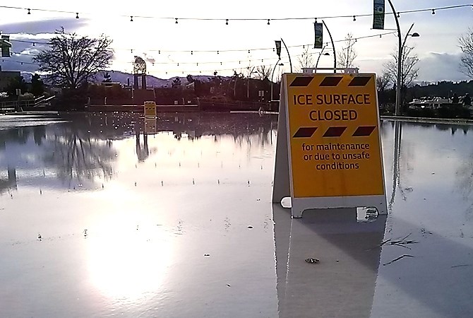
Downtown Kelowna’s Stuart Park Arena was closed in January when the soaring temp turned the ice rink into a large, wet puddle.
(ADAM PROSKIW / iNFOnews.ca)
April Fool’s storm in Atlantic Canada
An end-of-March storm that developed off the Eastern Seaboard of the United States inched its way southeast of Nova Scotia to become an April Fool’s storm for those who thought maybe, just maybe, it was spring in Atlantic Canada.
Severe September storm in Ontario
Following one of the hottest and most humid summer days on September 5, a severe thunderstorm tracked through southern Ontario from west to east.
To contact a reporter for this story, email Jennifer Stahn at jstahn@infonews.ca or call 250-819-3723. To contact an editor, email mjones@infonews.ca or call 250-718-2724.
News from © iNFOnews, 2014