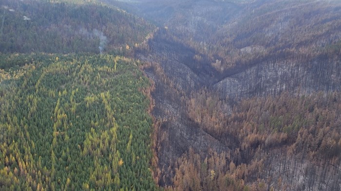
This photo shows an area 600-1,000 metres south of Naswhito Creek on the west side of Okanagan Lake that was burned by the White Rock Creek wildfire last summer. Areas that were logged and replanted escaped the fire, as did areas with deciduous trees.
Image Credit: Submitted/Bob Hrasko
October 23, 2021 - 4:37 PM
Hundreds of thousands of hectares of backcountry access in the Thompson Okanagan and Kootenays remain closed due to severe wildfire damage.
“Due to severe wildfire damage in areas of the Thompson Okanagan and one area in the Kootenays, 15 motor-vehicle closures under the Motor Vehicle Prohibition Regulation of the Wildlife Act are in effect,” according to a press release issued by the Ministry of Forests, Lands, Natural Resource Operations and Rural Development.
The closures affect backcountry roads across 536,000 hectares of land, due to concerns including the impact to habitats that need time to recover, erosion of charred soils and the impacts to fish habitat, increased vulnerability of wildlife due to migration disruptions, habitat loss and improved sightlines for hunting where vegetation was burned and increased access to wildlife habitat due to the construction of approximately 2,900 kilometres of fire guards, according to the ministry.
READ MORE: Kamloops Fire Centre sees record-breaking number of hectares burned this year
Closure boundaries have been created using landmarks such as roads, rivers and streams near wildfire perimeters. The closures do not affect community residents or access for commercial activities other than hunting.
The closures are intended to be in place while recovery efforts are planned and initiated. It is unknown how long the closures will remain in effect, according to the province.
Some exceptions to these prohibitions will be provided to ensure that throughfares remain open and access to private property is not affected.
Maps of the area, including downloadable georeferenced maps, are available online through the province’s website.
To contact a reporter for this story, email Carli Berry or call 250-864-7494 or email the editor. You can also submit photos, videos or news tips to the newsroom and be entered to win a monthly prize draw.
We welcome your comments and opinions on our stories but play nice. We won't censor or delete comments unless they contain off-topic statements or links, unnecessary vulgarity, false facts, spam or obviously fake profiles. If you have any concerns about what you see in comments, email the editor in the link above.
News from © iNFOnews, 2021