Image Credit: Photo contributed
January 02, 2024 - 12:02 PM
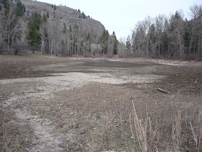
It’s now official, Kamloops and the Okanagan had their driest year on record going back more than a century. It was also close to the warmest on record.
Kamloops had 142.5 millimetres of precipitation in 2023, which is 51.3% of the city's normal precipitation of 277.6 mm. The records for Kamloops go back to 1897.
Kelowna only had 37.3% of its normal precipitation, recording 144.5 mm compared to 386.9 mm. That’s the driest the city has been since records started being collected there in 1903.
Penticton came in at 42.3% of normal with 146.3 mm compared to 346 mm. Its records go back to 1909.
Environment Canada did not have comparable precipitation data for Vernon.
When it came to temperatures, all four cities were well above normal for mean annual temperatures.
Vernon and Penticton recorded their warmest years on record while Kamloops and Kelowna had their third warmest on record.
The mean temperature in Vernon was 10 Celsius compared to a normal of 7.7 C for the year. Penticton’s mean temperature was 10.6 C versus a normal of 9.5 C.
Kelowna’s mean temperature in 2023 was 10.4 C versus a normal of 8.1 C, while Kamloops recorded a 2023 mean temperature of 10.8 C compared to a normal of 9.3 C.
“The further north and east you go, the more likely for it to be the driest and warmest on record,” Environment Canada meteorologist Brian Proctor told iNFOnews.ca Tuesday, Jan. 2, noting places like Smithers, Dease Lake, Chetwynd, Fort St. John, Fort Nelson, Watson Lake, Faro and Old Crow all recorded their warmest years on record.
“We came into the fall and winter in a moisture deficit/drought situation across much of the province and we’ve seen very little to alleviate any of those concerns,” he said.
The situation has eased a bit on the central North Coast and western Vancouver Island with some heavy rainfall but there’s not much in the way of snowpack building there or in the Interior.
“That’s the biggest concern moving forward – what the impacts of that might be on an agricultural basis, on a wildfire basis and on a general water allocation and use basis – so lots of concerns right now,” Proctor said.
While the Okanagan is in fairly good shape because it has a lot of storage capacity, especially in Okanagan Lake, that’s not the same for other parts of the province, especially in the Lower Mainland.
READ MORE: Is 2024 the year Okanagan Lake floating bridge becomes a suspension bridge?
“They use so much, given their population density,” Proctor said. “They recharge a lot of their reservoirs with rainfall over the wintertime but we haven’t seen a lot of moisture getting into the inner South Coast. It’s really been an outer Coast phenomenon and a North Coast phenomenon. And they’re going to need that snowpack later in the year to give them moisture to hold them through June, July and August.”
To contact a reporter for this story, email Rob Munro or call 250-808-0143 or email the editor. You can also submit photos, videos or news tips to the newsroom and be entered to win a monthly prize draw.
We welcome your comments and opinions on our stories but play nice. We won't censor or delete comments unless they contain off-topic statements or links, unnecessary vulgarity, false facts, spam or obviously fake profiles. If you have any concerns about what you see in comments, email the editor in the link above. SUBSCRIBE to our awesome newsletter here.
News from © iNFOnews, 2024