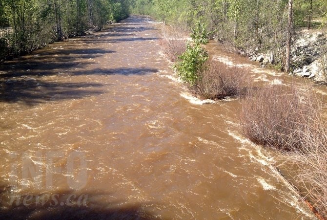
Mission Creek in Kelowna.
(ADAM PROSKIW / iNFOnews.ca)
June 06, 2020 - 12:00 PM
This is the time of year when thoughts of Okanagan residents often turn to floods – especially after the dramatic and devastating spring floods of 2017 and 2018.
Recent flooding from Mill Creek, near downtown Kelowna, served as a warning to how quickly creek waters can rise.
While those can cause expensive damage to creekside and waterfront homes, the fact is that Mission Creek in Kelowna not only carries about one third of the water entering Okanagan Lake but also a huge proportion of the material to create huge sandy beaches at places like Rotary and Gyro parks.
“That’s how Kelowna was born, long before people lived there,” Shaun Reimer, section head for public safety and protection with the Ministry of Forests, told iNFOnews.ca. “It’s built on these alluvial sands with sediment and sands and things that are brought down from the mountains and they fill up and form what is essentially a delta.”
That delta grows at the mouth of Mission Creek at this time of year and, over the course of the summer, winds push it northward.
“It’s what we call littoral drift,” Reimer said. “That basically refers to the sediment that moves up and down the shoreline due to wave action. The predominant wave action there is from the southwest to the northeast.”
It’s blocked by the Bennett bridge from travelling even further north. Some of it drifts down into deeper parts of the lake.
It also drifts into the Cook Road boat launch, forcing the city to dredge it each summer.
This year’s Mission Creek delta is actually smaller than it was in peak years like 2017 and 2018 because less debris is being carried down the creek.
So far, the slow and steady melt has made for a good spring runoff, Reimer said. Most of the middle elevation snow is gone and the higher elevation snow has compacted.
But, the snowpack was very heavy this winter and the upper elevation snow now has about a 50 per cent water content, as opposed to about 25 per cent in January and February.
“Right now, we’re still at a point where we could be vulnerable to the kind of rain events we saw last weekend,” Reimer said.
Warm temperatures combined with rain could melt that soggy upper elevation quickly and cause a rapid rise in creek flows, he said. It will be helpful if temperatures cool at night to slow the rate of melt.
Okanagan Lake was drawn down quite a bit this winter and is now within about 30 cm of full pool. A heavy rainfall could raise the lake level by five or six centimetres but there is still another 24 or 25 cm. above the targeted full pool level before flooding from the lake becomes a serious concern.
“Right now, things are looking very good for both maintaining a healthy water supply in Okanagan Lake and to not go over, at least significantly (the full pool),” Reimer said. “We’re going to be watching the rate of rise of Okanagan Lake over the next week or so. Our outflows now are fairly moderate, which gives us the ability to increase them and affect the rate of rise, at least a little bit.
The weather forecast for the next week in Kelowna calls for mainly cloudy skies, not much rain, highs in the low 20s and lows below 10C.
This story was orginally published May 21.
To contact a reporter for this story, email Rob Munro or call 250-808-0143 or email the editor. You can also submit photos, videos or news tips to the newsroom and be entered to win a monthly prize draw.
We welcome your comments and opinions on our stories but play nice. We won't censor or delete comments unless they contain off-topic statements or links, unnecessary vulgarity, false facts, spam or obviously fake profiles. If you have any concerns about what you see in comments, email the editor in the link above.
News from © iNFOnews, 2020