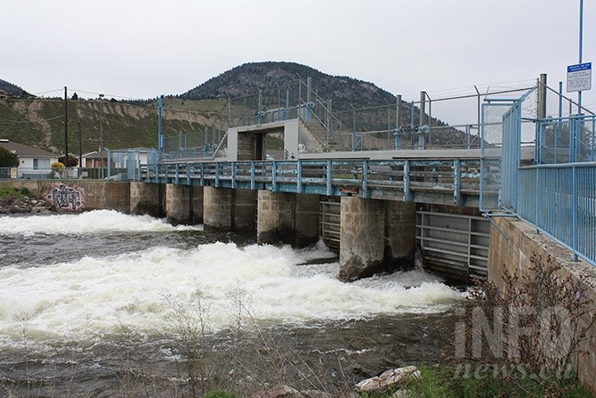
FILE PHOTO- Public safety section head Shaun Reimer says more water than is seasonally normal is flowing through the Okanagan Lake dam in Penticton with local snowpacks at higher than normal levels for this time of year.
(STEVE ARSTAD / iNFOnews.ca)
January 20, 2020 - 7:00 AM
Snow has been falling and snowpacks are on the rise across the Thompson and Okanagan, but it’s too soon to know whether there will be flooding this year.
That doesn't mean those in charge aren't preparing for all scenarios.
Shaun Reimer makes the call about how much water to leave in Okanagan Lake and how much will be let out into Skaha Lake. He says the rapid increase in snowpack has happened before, but it’s too early to assess how this spring’s freshet is going to go.
“Okanagan Lake is still a few centimetres over its January target, and was heading that way even before this week’s cold weather and snow,” Reimer says.
“That prompted me to increase the outflows from Okanagan Lake dam to a higher than seasonal level, but not in an extreme way.”
Reimer began releasing more water just over a week ago, when Okanagan Lake began rising a few centimetres from the warmer weather and snow melt that was occurring earlier in January.
“We did that in order to reach our monthly target levels. We’ll have a much better understanding after the February monitoring of the snow pack is complete. That’s when we receive an information forecast from the B.C. River Forecast Centre,” he says.
Reimer says the valley is not in a drought situation right now, but calls it “a difficult term.”
“It’s kind of a case of all bets are off right now. It’s looking better for water supply and a non-drought than years like last year at this time. Back then it looked like we were going into summer drought, but the summer rains really mitigated a lot of the impacts of what it could have turned into,” he says.
Reimer says conditions right now are similar to those of 2014, where early high snowpack levels did not translate into either a drought or high water year.
“It’s just too early to make any definitive calls,” he says.
The BC River Forecast Centre recently issued a commentary of snow conditions for January, noting several storm systems have impacted the region over the past two or three weeks, leading to “significant growth in the provincial snow pack.”
The centre says the West, North Thompson, South Thompson and Okanagan are nudging into high snow pack conditions at more than 120 per cent of normal, with 55 per cent of the annual provincial snow accumulation already having occurred by mid-January.
To contact a reporter for this story, email Steve Arstad or call 250-488-3065 or email the editor. You can also submit photos, videos or news tips to tips@infonews.ca and be entered to win a monthly prize draw.
We welcome your comments and opinions on our stories but play nice. We won't censor or delete comments unless they contain off-topic statements or links, unnecessary vulgarity, false facts, spam or obviously fake profiles. If you have any concerns about what you see in comments, email the editor in the link above.
News from © iNFOnews, 2020