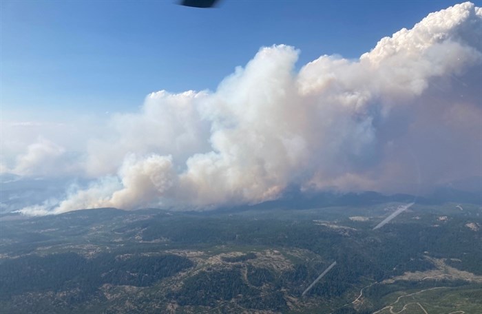
An aerial image of the White Rock Lake wildfire, taken on July 26, 2021.
Image Credit: B.C. Wildfire Service
August 03, 2021 - 1:30 PM
The White Rock Lake wildfire is now estimated to cover 32,500 hectares with the eastern portion of the blaze burning 15 kilometres from West Side Road.
B.C. Wildfire Service now says the wildfire to be 34 kilometres from Vernon, but it has spread in multiple directions.
On Aug. 3, a southwest wind of 10 to 20 km/h is expected to fan the flames in the afternoon and ease off into the evening, according to the BC Wildfire Service.
The eastern excursion reaching toward West Side Road began on July 31 with unexpected wind from the northwest pushing the blaze to travel 14 kilometres overnight, according to fire information officer Shannon Street.
READ MORE: Flights resume at YLW
The weekend rain scattered around the wildfire area was a short reprieve for firefighters, but fuel is expected to dry as temperatures reach around 30 C on Aug. 3.
Four surrounding regional districts, and the Okanagan Indian Band, have issued hundreds of evacuation orders and alerts, with at least 561 ordered to evacuate in the Central Okanagan on Aug. 1.
There are 136 firefighters assigned to the White Rock Lake wildfire, with 11 helicopters and 42 pieces of heavy equipment. There are also eight "danger-tree" fellers at the scene.
With many properties potentially at risk of the wildfire, the wildfire service has assigned 110 structure protection personnel to the scene from 35 different fire departments.
They will be rotating shifts to work 24-hours-a-day, deploying to multiple communities along West Side Road, including Okanagan Indian Band, and north to Westwold and Falkland. These crews will also douse hot spots along Douglas Lake Road.
Wildfire crews are now patrolling the northwest and southwest perimeters to stop any excursions from established fireguards. Meanwhile, crews are establishing fire guards on the northeast of the blaze and working southward, east of Salmon Lake, according to the wildfire service.
Go here for emergency service and evacuation updates from the Thompson Nicola Regional District.
Go here for updates from the Columbia Shuswap Regional District.
Go here for updates from the Regional District of North Okanagan.
Go here for updates from the Regional District of Central Okanagan.
Go here for updates from the Okanagan Indian Band.
To contact a reporter for this story, email Levi Landry or call 250-819-3723 or email the editor. You can also submit photos, videos or news tips to the newsroom and be entered to win a monthly prize draw.
We welcome your comments and opinions on our stories but play nice. We won't censor or delete comments unless they contain off-topic statements or links, unnecessary vulgarity, false facts, spam or obviously fake profiles. If you have any concerns about what you see in comments, email the editor in the link above.
News from © iNFOnews, 2021