Image Credit: Google Earth Engine
March 26, 2015 - 10:41 AM
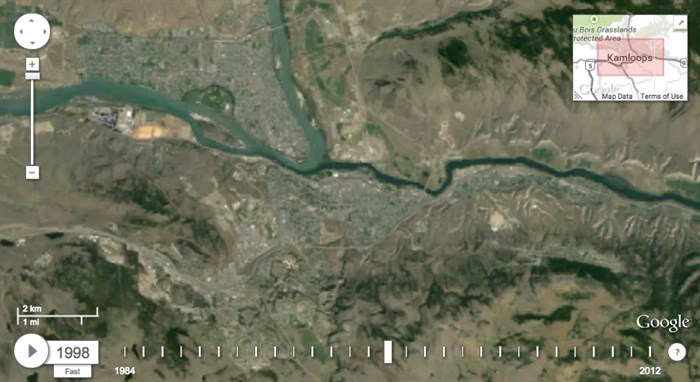
KAMLOOPS - If you’ve ever wondered how our city has changed in the last 30 years there’s a Google map for that.
You can now see annual satellite images from 1984 to 2012 in a time lapse on Google Earth Engine. While it doesn’t show the latest growth in areas where a lot of construction has taken place in the last few years, such as Sun Rivers and Aberdeen, just take a look at Juniper for evidence of how quickly some areas are growing.
You will see Kaloops grow to about 86,000 from 62,000 over those thirty years. You will also see the changing agriculture around the city and if you scroll up and zoom in on the Sun Peaks area you will see the area grow from a couple of runs to the large resort it is today.
You’ll also notice the change in the surrounding forest with the addition of many cut-blocks and further north the devastation of the 2003 fire is evident in the Barriere area. The growth of the Highland Valley Copper mine near Logan Lake is definitely worth looking at as well.
What did you notice? Tell us in the comments below.
**Please note: This time lapse will not play on mobile devices.
Credit: Google Earth Engine
To contact a reporter for this story, email Jennifer Stahn at jstahn@infonews.ca or call 250-819-3723. To contact an editor, email mjones@infonews.ca or call 250-718-2724.
News from © iNFOnews, 2015