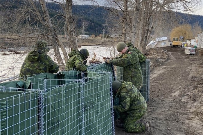
Military personnel are assisting city crews and contractors to reinforce the banks of the Coldwater River in Merritt.
Image Credit: TWITTER/City of Merritt
November 30, 2021 - 7:00 PM
At least 50 properties near Brookemere have been ordered to evacuate Tuesday afternoon as a log jam upstream could threaten those homes.
The Thompson Nicola Regional District issued the order around 2 p.m., Nov. 30, after provincial government staff found the log jam roughly two kilometres upstream from Brookemere, which is south of Merritt.
"Given the weather forecast and the potential for increased water levels, there is concerns that this log jam could be dislodged and carried downstream in to Brookmere, where it could cause further damage," the regional district news release states.
The evacuation order is the latest in a nearly two-week stretch of flood impacts across southern B.C., which began on Nov. 15.
READ MORE: Provincial health officer relaxes strict COVID restrictions in Interior Health
Today marks the beginning of the latest atmospheric river, bringing rains across Vancouver Island, the south coast and into parts of the southern interior.
But B.C. isn't the only place experiencing flooding.
South of the border, the same storms have taken watersheds in Washington over capacity, flooding areas around the Sumas and Nooksack rivers.
In Whatcom county, the flooding has caused an estimated $50 million in damage, while the Sumas River impacted Abbotsford as it flowed past the Canadian border.
READ MORE: Kamloops man assaulted for removing anti-homeless sign
The Nooksack River does not cross the international border and instead travels to the Pacific from Washington, but its overflow has travelled across into the Sumas River.
On the northern side of the border, the City of Merritt continues to work toward bringing all residents back to their homes, even if only day access is permitted for those most affected.
City crews and their partners continue to prepare as the latest storm moves into the Coquihalla region, but the City is hesitant to determine exactly when all residents can return.
"If water overtops the banks and flooding occurs, then the infrastructure may once again be affected and plans to allow the return of residents in Phase 3 and Phase 4 may be set back," a Nov. 30 news release from the City of Merritt reads.
READ MORE: British Columbia braces for third 'atmospheric river' after recent floods
Merritt will not be directly impacted by the storm, but the Coldwater River watershed encompasses over 300 square kilometres, including the Coquihalla area, according to the release.
If all goes as planned with flood mitigation currently in place, residents who have not yet been allowed day access to their homes will return by Friday, Dec. 3.
Most of the central and south coast are currently on flood watch notice, according to the B.C. River Forecast Centre, as is all of Vancouver Island and parts of the interior, including the Coldwater and Nicola river basins.
Armel Castellan, a meteorologist with Environment Canada, said the central coast and the west coast of Vancouver Island could see up to 150 millimetres of rain, with up to 120 mm in Bella Coola, while the flood-soaked Fraser Valley east of Abbotsford could get up to 80 mm.
In anticipation of the incoming storm, Highway 99 between Pemberton and Lillooet is closed on Nov. 30, as of 4 p.m.
READ MORE: Penticton thrift shop discovers U.S. cash inside donated laptop bag
According to the Ministry of Transportation and Infrastructure, highway infrastructure is vulnerable as the precipitation will add more moisture to the already saturated earth.
Crews will be back on the ground Wednesday morning to re-evaluate the roadway before opening again.
Highway 3 remains open for essential travel, connecting Hope to Princeton.
Go here for evacuation notices from the Thompson Nicola Regional District.
Go here for up-to-date information on B.C. highways from DriveBC.
— With files from The Associated Press and The Canadian Press.
To contact a reporter for this story, email Levi Landry or call 250-819-3723 or email the editor. You can also submit photos, videos or news tips to the newsroom and be entered to win a monthly prize draw.
We welcome your comments and opinions on our stories but play nice. We won't censor or delete comments unless they contain off-topic statements or links, unnecessary vulgarity, false facts, spam or obviously fake profiles. If you have any concerns about what you see in comments, email the editor in the link above.
News from © iNFOnews, 2021