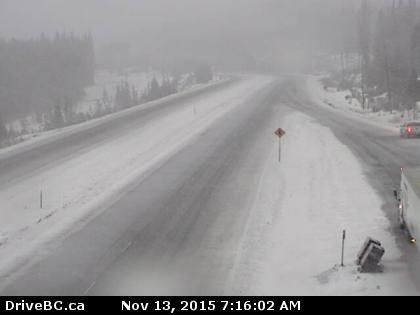
Snow is expected to turn to rain over the Okanagan Connector this weekend.
Image Credit: Drive B.C.
November 13, 2015 - 8:30 AM
OKANAGAN - A storm system skirting much of the region will move on this morning, though a weekend of rain is still in store for the Okanagan.
The strongest winds came in the Penticton area yesterday, Nov. 12, with Environment Canada recording strong wind gusts since yesterday morning and the strongest reaching in excess of 75 kilometres per hour.
The weather office expects those strong winds to die down throughout the much of the region by this afternoon, with a chance of showers will persist through early afternoon as well. Rain is expected to begin again by late afternoon on Saturday and continue through Sunday.
Vernon woke to seasonal normal high temperatures of 4 C while Kelowna and Penticton welcomed temperatures already at 7 C and 9 C by 6 a.m. Temperatures will rise slightly throughout the region today, with highs of 9 C to 11 C being forecast. Overnight lows will dip to between 3 C and 6 C Friday and Saturday night while Sunday night will see temperatures fall a few degrees below the seasonal normal low of -1 C, with a low of -4 C expected.
The wind and snow hit area highways hard over the past couple of days, with 28.1 centimetres of snow currently on the ground at the Coquihalla Summit, 18.5 cm at Allison Pass on Highway 3, 25.6 cm at Pennask Summit and 36.3 cm at Albert Canyon, with heavy snow still coming down.
Forecasters are warning of poor driving conditions at Rogers Pass on Highway 1 today, with another 10 to 20 cm of additional accumulation expected before the snow turns to rain this afternoon.
Avalanche forecasters have also increased the avalanche risk at treeline and alpine levels, with a high risk expected by Saturday in Glacier, Little Yoho, Banff, Yoho and Kootenay National Parks. This level four risk level is put in place when conditions are considered very dangerous and travel in avalanche terrain is not recommended.
To contact a reporter for this story, email Jennifer Stahn at jstahn@infonews.ca or call 250-819-3723. To contact an editor, email mjones@infonews.ca or call 250-718-2724.
News from © iNFOnews, 2015