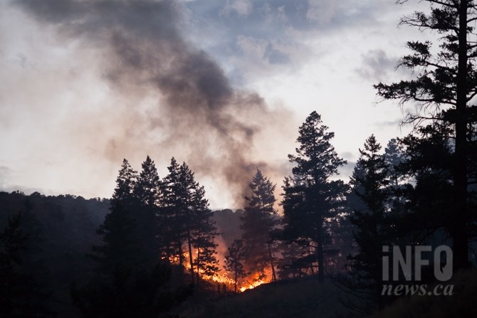
FILE PHOTO
(KIM ANDERSON / iNFOnews.ca)
July 03, 2021 - 7:30 AM
With wildfire season well underway in the B.C. Interior, it's important to be aware of what is going on so you can keep yourself and your family safe.
Fortunately, the federal, provincial and municipal governments, along with other agencies, provide resources so a lot of the information you need will be at your fingertips.
They can answer questions you might have from where a fire is, what is the air quality where you live and how to be alerted in an emergency situation.
How to Prepare
If you have never experienced a disaster before, it can come quickly if you're not prepared. The Village of Lytton tragically experienced just how quickly a wildfire can spread when conditions are hot and dry. After breaking the national heat record for three consecutive days, a wildfire swept through the village on July 1.
The Province of B.C.'s website has helpful tips on the risks to keep in mind, how to make a plan, and what to pack in your go-bag when it's time to evacuate.
Important tips include keeping a three-day to one week food and water supply, keeping enough fuel in your vehicle to evacuate from your community, having a phone charger with a battery bank or inverter and packing copies of important documents like insurance and identification.
More information on how to pack your emergency kit can be found here.
B.C. Wildfire Service interactive map
The B.C. Wildfire Service updates their map every two hours as new information is available. The wildfire service plots each fire with symbols to indicate whether a fire is "out of control," "being held," or "under control."
Users can also navigate tabs on the left-hand side, which will show how many fires are active in each fire centre region, how many fires there have been throughout the season, and active fire bans in each region.
See here for more information on how to navigate the interactive wildfire map.
See the interactive B.C. Wildfire map here.
The wildfire service also regularly update their Twitter account with notable fires and photos.
Fire smoke forecast
Firesmoke.ca maps current and forecasted wildfire smoke conditions throughout Canada and the US.
Like a weather forecast, it projects smoke movement during wildfires, while also showing the severity of particulate matter within that smoke.
Go here to see the current fire smoke forecast.
Social Media
Your local community social media groups can make neighbours aware of emergencies in your area. There are also more regional Facebook pages full of users posting updates, photos and videos of ongoing fires or emergencies.
Interior Weather Watchers has thousands of users keeping tabs on storms and fires in Interior regions and throughout the province.
Coquihalla Road Reports will have multiple updates from drivers passing through Highway 5, and Highways 1, 3, 7 and 97C, including fires, storms and icy conditions.
Regional districts
Each regional district in the Thompson-Okanagan addresses emergency situations differently, but all have maps and a notification method when disasters strike.
The Thompson-Nicola, South Okanagan and Central Okanagan regional districts all use interactive maps showing active emergency alerts and orders.
Resident in the North Okanagan region can watch the regional district website here for map updates when there are ongoing emergencies.
Thompson-Nicola Regional District recently began using the Voyent Alert! app, which residents can opt to install to their smartphones. Users can input their address and will receive alerts when there are fires, floods or water advisories, for example, in their area. The notification will alert smartphones similarly to the B.C. provincial alert system.
South Okanagan Regional District uses a similar mass alert system called CivicReady. Users can sign up to receive alerts via text, email and/or phone call here.
Residents in all four regional districts get on a mailing list to receive emailed alerts. See your regional district website to sign up for the mailing list.
Environment Canada
Environment Canada hosts an array of resources for B.C. residents keeping watch for current weather or smoke conditions.
Their website hosts a map of current extreme weather alerts here.
Environment Canada will also display the current air quality health index in your area here, which can be even more helpful when used in conjunction with the fire smoke forecast here.
To contact a reporter for this story, email Levi Landry or call 250-819-3723 or email the editor. You can also submit photos, videos or news tips to the newsroom and be entered to win a monthly prize draw.
We welcome your comments and opinions on our stories but play nice. We won't censor or delete comments unless they contain off-topic statements or links, unnecessary vulgarity, false facts, spam or obviously fake profiles. If you have any concerns about what you see in comments, email the editor in the link above.
News from © iNFOnews, 2021