Image Credit: SUBMITTED/Erin Tilley Photography
June 08, 2023 - 4:30 PM
After weeks of almost unbroken sunshine and heat, some respite may be on the way for Kamloops and the Okanagan.
But it won’t last long and there may thunderstorms.
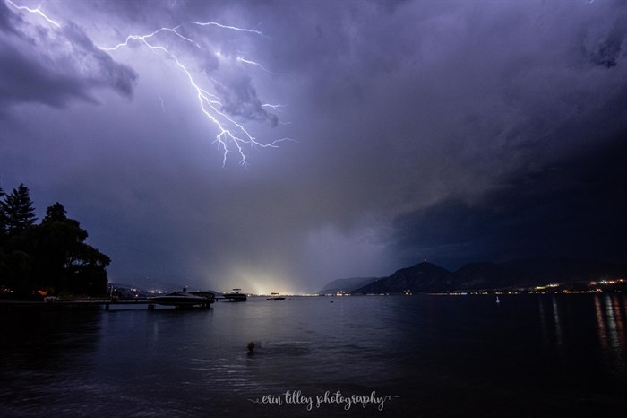
“The chances of having dry lightning are not insignificant,” Environment Canada meteorologist Armel Castellan told iNFOnews.ca.
The low pressure system coming into the province is unpredictable. Yesterday, June 7, for example, forecasters were expecting up to 10 mm of rain to fall on Vernon tomorrow.
Now it looks like the system is shifting south so Osoyoos could get 10 to 20 mm of rain, depending on where thunderstorms hit, Castellan said.
There could still be a “handful of millimetres” of rain into the Central and North Okanagan, but the Kootenays are more likely to feel the full brunt of the system. Showers are also still in the forecast for Kamloops and there could be lightning.
Smoke is moving into the Merritt and Lytton areas today from fires in the Lower Mainland near Harrison but it’s not expected to have a big impact on Kamloops and the Okanagan, certainly not like the high levels of smoke experienced from May 16 to 18, Castellan said.
The biggest fires in BC are in the northeast corner.
That area could be hit with lightning this weekend but the smoke is expected to mostly affect the north central areas of the province, around McKenzie, and north into Yukon before shifting eastward next week.
Of course, Castellan noted, the smoke impact for the Thompson-Okanagan depends heavily on whether new wildfires ignite.
READ MORE: Showers likely for southern B.C., as wildfires cut air quality, challenge control
The forecast for today is for mainly sunny skies with highs of 35 Celsius in Kamloops. There’s a 30-60% chance of showers from tonight through Saturday then sunny skies on Sunday and through next week.
The clouds could start moving into the Okanagan today with 40-60% chance of showers through Saturday, when temperatures could drop to highs of about 24 C.
The system is expected to clear out Sunday with temperatures returning to levels that are 4-8 C above normal for this time of year, meaning they will start going above 30 C again.
Right now, the fire danger rating for much of the Thompson-Okanagan region is high with spots of extreme danger. The South Okanagan, for the most part, shows a moderate fire danger rating.
June is normally the wettest month of the year, which has a huge impact on the wildfire situation. So, even if it rains a bit this weekend, it’s not likely to have much of an impact.
“It’s a drop in a bucket because we have a really big deficit,” Castellan said. “We need to have some moisture almost every day for four or five weeks into July to have any possibility of really mitigating the summer wildfire concerns.
“We saw that in 2019 – after the two big fire years of 2017 and 2018 where the very last few days of June and most of July were quite wet – so, it is possible. It’s unlikely. We’re not projecting that kind of a pattern, but it has happened in the past.”
To contact a reporter for this story, email Rob Munro or call 250-808-0143 or email the editor. You can also submit photos, videos or news tips to the newsroom and be entered to win a monthly prize draw.
We welcome your comments and opinions on our stories but play nice. We won't censor or delete comments unless they contain off-topic statements or links, unnecessary vulgarity, false facts, spam or obviously fake profiles. If you have any concerns about what you see in comments, email the editor in the link above.
News from © iNFOnews, 2023