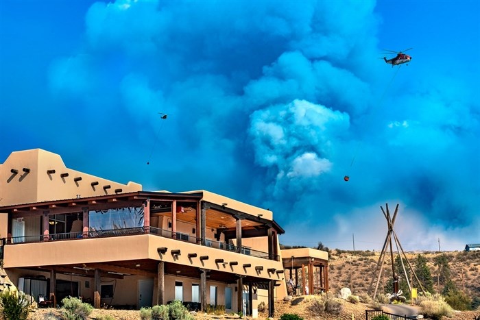
The Nk'Mip Creek Wildfire at Tucelnuit Lake, July 27, 2021.
Image Credit: John Poon/johnpoon.ca
August 03, 2021 - 3:00 PM
The Nk'Mip wildfire north of Osoyoos has covered an estimated 16,000 hectares according to a Tuesday morning aerial assessment.
The B.C. Wildfire Service is patrolling residential areas near McKinney Road, Nk'Mip Road, Shrike Hill and south around Anarchist Mountain on Aug. 3, while fire guards are built at the northeast and southeast flanks.
The wildfire service will also survey the area around Mount Baldy Ski Resort and McKinney Nordic Ski Club for potential planned ignitions.
The Nk'Mip wildfire was first discovered on July 19 and remains out of control. While it was mapped at 13,000 hectares as recently as Aug. 2, several days of heavy smoke hampered the wildfire service from providing any new estimates.
There are currently 186 firefighters assigned to the blaze, with six helicopters and 34 heavy equipment units. Along with other support staff, there are 46 structure protection personnel at the Nk'Mip wildfire.
Evacuation orders and alerts have been issued by the Osoyoos Indian Band, the Regional District of Okanagan Similkameen and the Regional District of Kootenay Boundary.
Go here for evacuation updates and emergency services from the Regional District of Okanagan Similkameen.
Go here for updates from the Regional District of Kootenay Boundary.
To contact a reporter for this story, email Levi Landry or call 250-819-3723 or email the editor. You can also submit photos, videos or news tips to the newsroom and be entered to win a monthly prize draw.
We welcome your comments and opinions on our stories but play nice. We won't censor or delete comments unless they contain off-topic statements or links, unnecessary vulgarity, false facts, spam or obviously fake profiles. If you have any concerns about what you see in comments, email the editor in the link above.
News from © iNFOnews, 2021