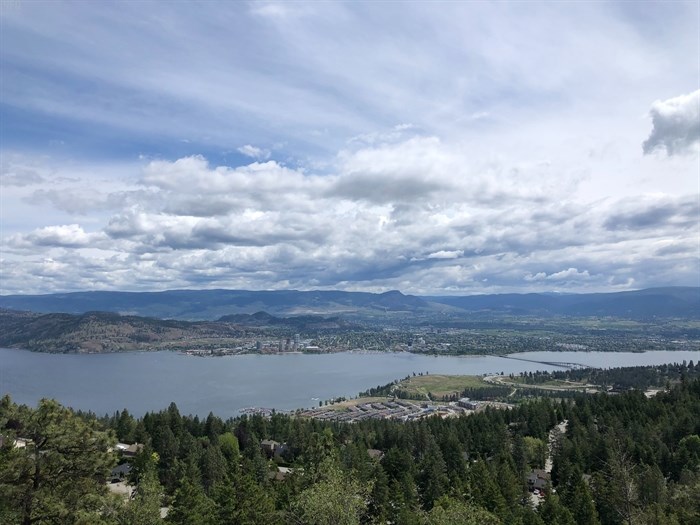
The view from the Rose Valley Regional Park.
Image Credit: Kathy Michaels
June 05, 2021 - 2:42 PM
Across the globe, the pandemic has sent people out to explore their own backyards, and for those who live in Kamloops and the Okanagan it couldn't be nicer.
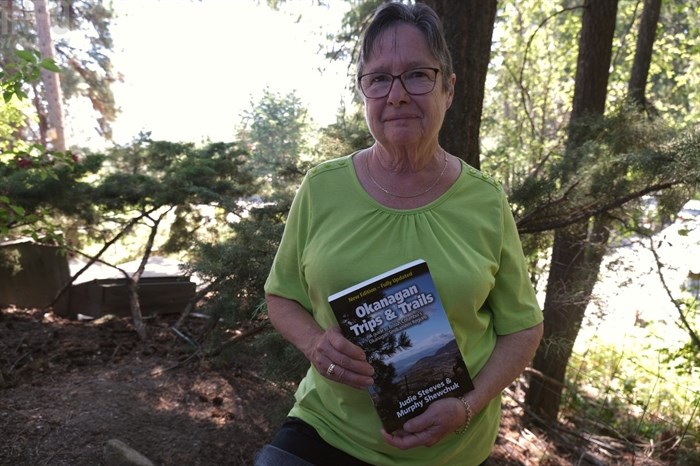
Judie Steeves, longtime Okanagan Valley outdoor enthusiast and co-author of Okanagan Trips and Trails: A guide to British Columbia’s Okanagan Similkameen Regions has a few hiking trails knows these areas best and she has a few ideas on what to explore ranging from easy flat trails to those that require a pair of good hiking shoes.
Rose Valley Regional Park
“It has an unbelievable network of trails in it,” Steeves said, adding the City of West Kelowna also added bike trails at the south end of the park. It is one of Steeves' favourite hikes and it’s suitable for families. Her book says it can take between one to four hours to complete and is good to hike year-round. An entrance to the trail network can be found on Westlake Road.
For more information on the trail network, visit the Regional District of Central Okanagan’s website.
Black Mountain - sntsk'il'nt?n Regional Park
This is one of the Central Okanagan’s newest regional parks and trails. If you start from Swainson Road there are “lovely little loops with good views of the cities and grasslands and there are forested areas higher up,” Steeves said. The park is co-managed with the Westbank First Nation and features 643 hectares of grassland.
Learn more about the park through the regional district’s website.
Bear Creek Falls
Steeves enjoys trails that lead to waterfalls this time of year. There’s a loop trail in Bear Creek Provincial Park, located along Westside Road. You need good hiking shoes and it’s only about five-kilometres long, she said.
BX Creek and Falls Trails
From the Tillicum Road trailhead take a short hike to the waterfalls or waterfall viewpoint or head past the viewpoint for a longer creekside hike. The trail splits to descend down to a shallow pool at the foot of BX Falls along a steep descending trail, according to Tourism Vernon. “I really do like waterfalls… it’s the perfect time of year to visit them because they’re at the maximum flow,” Steeves said.
Okanagan Mountain Provincial Park
This park has a huge network of trails that can be accessed on the east side of Okanagan Lake, opposite of Peachland, by following Lakeshore Road. It can also be accessed through Penticton along Chute Lake Road, but the road is gravel and rough, according to B.C. Parks.
Kalamoir Regional Park
One of the entrances to these hiking trails are located next to Quails’ Gate Winery in West Kelowna, so you can pick up a reward on the way down, she said. The regional park has 27.6 hectares of beautiful trails, according to the regional district.
Myra Canyon Provincial Park
Formerly the Kettle Valley Railway, you can walk or cycle to Penticton, following the old rail lines. One of Kelowna’s most well-known trails, access can be found using the Myra Forest Service Road. The KVR corridor is a significant part of the Trans Canada Trail, according to Steeves’ book. The trail takes about four hours from Myra to Ruth station.
Pincushion Mountain
This mountain gets its name from the rugged shape of the rocks with short pins of pines and firs poking out from its peak, according to Steeves' book. The hike is not for the faint of heart and can be accessed on Ponderosa Drive in Peachland. The top of the hike has a gorgeous view of Okanagan Lake. The hike is roughly two kilometres long and is very steep and rocky.
Okanagan Rail Trail
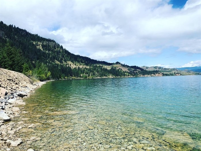
This popular trail was created along the old CN Rail line and stretches for 52 km from Coldstream to Kelowna, with the exception of one section on Okanagan Indian Band land. Walk or cycle along Kalamalka and Wood Lakes.
For more information, visit the rail trail’s website.

Kalamalka Lake along the Okanagan Rail Trail.
Image Credit: Kathy Michaels
Skaha Lake Rail Trail
You can access this trail, which provides a good cardio workout, according to Steeves, from Penticton, Kaleden and Okanagan Falls. The trail is roughly 14 km from Penticton to Okanagan Falls and can be accessed from the Okanagan Falls provincial campground. The trail is a former KVR line, part of the Osoyoos subdivision.
Kenna Cartwright Park
The Okanagan isn’t the only place that has hikes with gorgeous views. Kenna Cartwright Park in Kamloops is the largest municipal park in B.C. with more than 40 km of trails, according to Hike Kamloops. Great for all ages, the park can be accessed by Hillside Drive, Pacific Way or Home Depot.
Wade Road Trails
This short, one km long trail features a beautiful view of Adams River. The trail is located near Chase in the Tsútswecw (Roderick Haig-Brown) Provincial Park. The trail has cell service and is dog friendly, according to Hike Kamloops.
Hikes should note public access will be intermittently closed due to the C7îstkteñ Winter House project within Tsútswecw Provincial Park, according to B.C. Parks.

Judie Steeves, co-author of Okanagan Trips and Trails: A guide to British Columbia’s Okanagan Similkameen Regions, is passionate about the outdoors.
(CARLI BERRY / iNFOnews.ca)
For more trail ideas around the Okanagan, Steeves book can be purchased through Mosaic Books, Indigo or the Fitzhenry and Whiteside publishing company website.
— This story was updated on June 8, 2021 to correct the location of the Wade Road Trails.
To contact a reporter for this story, email Carli Berry or call 250-864-7494 or email the editor. You can also submit photos, videos or news tips to the newsroom and be entered to win a monthly prize draw.
We welcome your comments and opinions on our stories but play nice. We won't censor or delete comments unless they contain off-topic statements or links, unnecessary vulgarity, false facts, spam or obviously fake profiles. If you have any concerns about what you see in comments, email the editor in the link above.
News from © iNFOnews, 2021