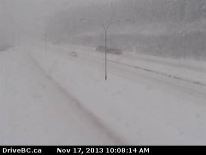
The B.C. highway cam at the Coquihalla Summit looking north at an elevation of 1210 m. You can see the snow has already started to fall at higher elevations.
Image Credit: Drivebc.ca
November 17, 2013 - 10:19 AM
SPECIAL WEATHER STATEMENT ISSUED
KELOWNA – Just when you thought it was safe to make a break for the coast or Alberta, the snow is coming back.
A storm system dumped up to 40 cm on the mountain passes in the Southern Interior late last week, turning them into winter wonderlands.
While the snow was good news for ski hills like Big White that celebrated one of it’s earliest opening days in history, the white stuff is problematic for drivers. Compact snow, blowing snow, slushy and slippery sections greeted drivers at higher elevations over the weekend.
Well, the Environment Canada has issued a special weather statement, giving you a heads up that more snow is coming on Sunday and Monday, and into the week.
The meteorologists tell us a low pressure centre currently off the southern Alaska panhandle will track across the southern part of the province Sunday and early Monday morning.
It will bring significant snowfall in the mountain passes again. The forecasters figure the Coquihalla summit could get between 25 to 40 cm, while the Rogers Pass and the Allison Pass can expect up to 20 cm.
Then over the early part of next week, another low pressure system will hit that cold Arctic air mass producing even more snow.
Drivers on the Coquihalla highway from Merritt to Hope, the TransCanada from Eagle Pass to Rogers Pass and Highway 3 from Princeton to Hope through the Allison Pass need to have winter tires or chains.
Be sure to check with Drive B.C. before you head out.
News from © iNFOnews, 2013