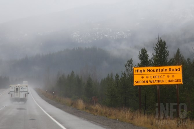
Motorists beware: The Coquihalla and other mountain highways could see heavy snow over the next 36 hours while mostly rain falls in Kamloops, Vernon, Kelowna and Penticton.
(JENNIFER STAHN / iNFOnews.ca)
January 11, 2021 - 11:46 AM
Motorists intending to use mountain passes in and out of Kamloops and the Okanagan should prepare for some nasty winter driving conditions over the next 36 hours.
Environment Canada meteorologist Doug Lundquist says drivers shouldn’t let the continuing balmy conditions in the valley bottoms in Kamloops and the Okanagan fool them.
“In the high terrain, it’s winter up there,” Lundquist says.
Heavy snow is expected over the next day and a half, particularly on the Hope to Merritt portion of the Coquihalla Highway.
Lundquist says 15 to 30 centimetres are expected on the route between tonight, Jan. 11, and tomorrow evening.
“That could be mixed with rain, making for a slushy mess. We are also in a weather pattern that could create high avalanche risk this week,” he says.
Kamloops and Penticton will likely see mostly rain and rain showers, with more strong, gusty winds expected, especially in the Penticton area.
Vernon and Kelowna could see two to four cm of snow overnight before turning to rain tomorrow, while up to 10 mm of rain could fall in Osoyoos.
South wind gusts could approach 80 km/h in Penticton with gusts of 40 to 60 km/h in Kelowna and Vernon over the next 24 hours.
Kamloops could see winds from the east in the 30 to 60 km/h range tonight and tomorrow.
Wednesday, the sun is expected to return, but clouds are anticipated by the weekend.
“It will be warm between now and Wednesday, cooling off a bit for the latter part of the week and then warming up on the weekend. It’s not quite record breaking yet, but by the weekend we might see some records fall,” Lundquist says.
Kamloops could see highs around 8 Celsius today through Wednesday, with Okanagan cities reaching highs of about 6 C.
Normal highs for Kamloops for mid-January are around -1 C . Vernon, Kelowna and Penticton normally see daytime highs of -2 C this time of year.
Lundquist says while it's not unusual for it to be this warm this time of year, it is unusual for it to be this warm for so long without an Arctic outbreak.
“We’re just about halfway through winter. It’s going to have to be really cold now for the season to finish below average for temperature,” he says.
To contact a reporter for this story, email Steve Arstad or call 250-488-3065 or email the editor. You can also submit photos, videos or news tips to tips@infonews.ca and be entered to win a monthly prize draw.
We welcome your comments and opinions on our stories but play nice. We won't censor or delete comments unless they contain off-topic statements or links, unnecessary vulgarity, false facts, spam or obviously fake profiles. If you have any concerns about what you see in comments, email the editor in the link above.
News from © iNFOnews, 2021