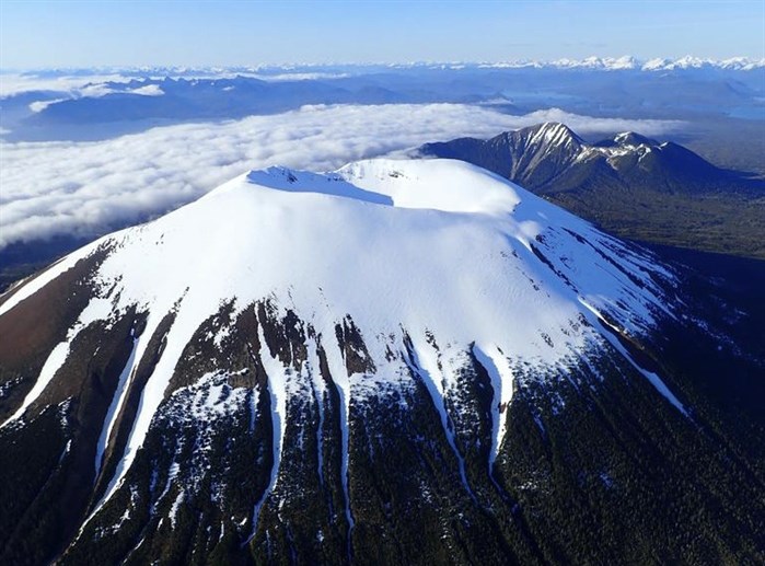
An aerial view of Mount Edgecumbe taken May, 19, 2022.
Image Credit: Max Kaufman/Alaska Volcano Observatory
October 26, 2022 - 9:00 PM
Scientists have detected moving magma under a long-dormant volcano 450 kilometres northwest of Prince Rupert, near Sitka, Alaska.
Mount Edgecumbe was a volcano not considered active so no one was looking at it, Ronnie Grapenthin, professor of geodesy at the University of Alaska Fairbanks said.
“There was no ground monitoring in place. Usually, on a volcano that is considered active or historically active, we put out seismometers and other ground measurement instrumentation. For Edgecumbe, we didn’t have any of that.”
Then, last April, there were a series of earthquakes that were large enough to be detected on a more regional network system. Instruments are in place to measure earthquakes created by tectonic plate movement.
When they investigated further, they found that some of the earthquakes were located straight under Mount Edgecumbe. Residents wanted to know if they were related to volcanic activity.
The Alaska Volcano Observatory collaborated with the Alaska Satellite facility to analyze data from the last seven years, looking for deformations in the ground at Edgecumbe. They found things have been changing since about 2018.
“In principle, what the rough surface is doing around Mount Edgecumbe is it’s moving up, similar to how you could imagine a balloon inflate. And it’s doing so, for a volcano in Alaska, at a fairly significant rate of about seven centimetres or so a year.”
Using modelling techniques, the researchers were able to link the ground deformations to magma moving up from 20 km below the surface to a shallower region about 10 km deep.
“What we believe is causing the earthquakes is that the magma is moving to a shallower depth and it needs to create space for itself. So the crust is kind of bulging upward a little bit and the tension that is created in the rock, because of that, results in breaking of rock and that created those local earthquakes.”
Mount Edgecumbe is not going to erupt anytime soon though, Grapenthin clarified.
“This magma intrusion has been going on for three-plus years now. Prior to an eruption, we expect more signs of unrest: more seismicity, more deformation and, importantly, changes in the patterns of seismicity and deformation.”
Last summer, the researchers installed some ground-based instrumentation and they are continuing to monitor activity at Edgecumbe.
“While it is not uncommon for volcanoes to deform, the activity at Edgecumbe is unusual because reactivation of dormant volcanic systems is rarely observed,” Grapenthin said.
According to Lingít oral histories passed down from Herman Kitka, the last eruption of Mount Edgecumbe was 800 to 900 years ago.
“As Tlingit members went up along the coast they saw a plume of smoke above a mountain. Some members of that party went up and investigated what the source of that was. They saw fires emerging from the mountain and more smoke that was being transported away by the wind, which gave Edgecumbe the Indigenous name blinking mountain,” Grapenthin said.
When the Alaska Volcano Observatory and Alaska Satellite Facility were analyzing data to detect ground deformations, they used cloud technology which was a first for them.
“In the past, we had to download data and supplementary information and process large volumes of data basically on local computer networks. All of that took a long time. What’s happened here is that we could process everything in the cloud.”
“The power of cloud computing means that you can process large volumes of data within days, for what usually would have taken you weeks or months.”
Grapenthin said they are making this a routine monitoring tool for the remaining volcanoes.
“This methodology allows us to keep an eye on more volcanoes in a different way than we are currently doing, improving our monitoring capabilities.”
Grapenthin is proud of the work the Alaska Volcano Observatory was able to accomplish as a partnership between three organizations, the United States Geological Survey, the Alaska State Division of Geology and Geophysical Surveys and the University of Alaska Fairbanks Geophysical Institute. He thought they worked very well together to understand how the Mount Edgecumbe volcano was working and to convey the information to local residents.
— This story was originally published by the Prince Rupert Northern View.
News from © iNFOnews, 2022