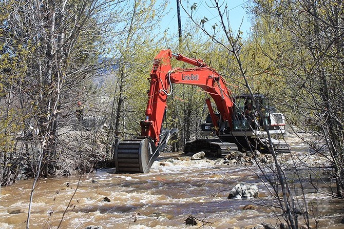
The first round of above normal temperatures is expected to cause an accelerated snow pack melt this week in the region. Above, a Penticton city work crew cleans up Ellis Creek in time for the spring freshet.
(STEVE ARSTAD / iNFOnews.ca)
April 23, 2018 - 3:47 PM
The weather is heating up and the threat of flooding from a sudden spring freshet in the Southern Interior is rising with it.
Environment Canada meteorologist Ross MacDonald says a strong high pressure system is building over the province that could bring most of us past 20 C.
“It’s the first sustained warmth of the spring. We’re going to see freezing levels rise to between 3,000 and 3,500 metres, which means an accelerated snowpack melt,” MacDonald says.
David Campbell with the province's River Forecast Centre says snowpacks in the Southern Interior have increased by five to 15 per cent since the beginning of April, as cooler temperatures this year have delayed the onset of melt by a couple of weeks.
Warmer temperatures this week are expected to trigger mid to high elevation melting, which is a welcome change from further accumulation at this point in the season, Campbell said.
Areas of concern for possible high flows include the South Okanagan, and Vernon areas, and the Similkameen and Tulameen River systems.
Campbell also noted the Cache Creek and Cariboo could see potentially high flows in those areas.
Larger river systems in the region aren’t expected to crest for several weeks.
Section Head of Public Safety and Protection for the Thompson Okanagan region Shaun Reimer says Kalamalka Lake is now 38 cm below full pool, 25 cm below last year’s level.
Okanagan Lake, now 106 cm below full pool, is expected to begin filling up this week with the beginning of the freshet.
“It should be manageable, but that’s not accounting for wet weather,” Reimer said.
A very weak cold front will bring cloudy and cooler weather into the region Tuesday night, but the temperatures rebound on Thursday and Friday with temperatures in the mid-20 C range. Temperatures are expected return to more seasonal norms on the weekend.
To contact a reporter for this story, email Steve Arstad or call 250-488-3065 or email the editor. You can also submit photos, videos or news tips to the newsroom and be entered to win a monthly prize draw.
We welcome your comments and opinions on our stories but play nice. We won't censor or delete comments unless they contain off-topic statements or links, unnecessary vulgarity, false facts, spam or obviously fake profiles. If you have any concerns about what you see in comments, email the editor in the link above.
News from © iNFOnews, 2018