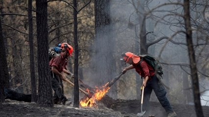
Image Credit: THE CANADIAN PRESS/Jonathan Hayward
July 20, 2014 - 9:01 PM
WEST KELOWNA - To help ensure public and firefighter safety, the Kamloops Fire Centre is restricting access to certain areas in and around the Smith Creek fire zone, even as many are returning to their homes.
An Area Restriction Order is in effect immediately and will remain in place until July 31, or until the order is rescinded. Anyone caught in the restricted area could be issued a fine up to $5,000 or spend six months in jail.
Fire information officer for the Smith Creek fire zone, Tracy Wynnyk, says even though the fire has passed through some of the areas under the order, there is still a lot of activity happening. There is heavy equipment and helicopters flying overhead and the restriction is in place to protect not just the public, but those still battling the fire.
"Once people go back to their homes, (they) might get curious and want to get up into these areas," she says. "Unfortunately, we spend quite a bit of time chasing them down and getting them out of these areas."
The order applies to the east boundary which includes Paramount Drive to Shannon Heights, following the fire perimeter. The south boundary includes Smith Creek Road, Copper Ridge Drive and continues east to the fire perimeter of Paramount Drive. The west boundary runs in a straight line from Smith Creek Road to the north boundary. A detailed map showing the restricted zone is available a the B.C. Wildfire website.
The area under order does not apply to people travelling to or from their home or to anyone using the highway as defined in the Highway Act.
For information about the Smith Creek wildfire, please visit www.bcwildfire.ca
You can also follow the latest wildfire news --
On Twitter at http://twitter.com/BCGovFireInfo
On Facebook at http://facebook.com/BCForestFireInfo
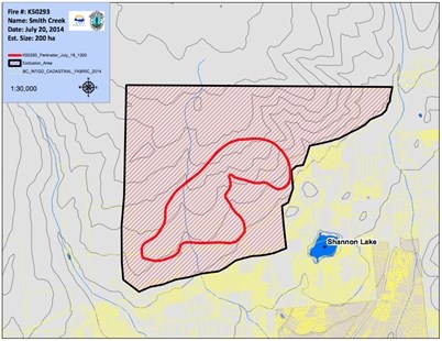
Map shows the boundaries for the Area Restriction Order issued July 20, 2014.
Image Credit: bcwildfire.ca
News from © iNFOnews, 2014