
Heavy snow is falling throughout the Thompson-Okanagan this morning, Oct. 23, 2020.
(STEVE ARSTAD / iNFOnews.ca)
October 23, 2020 - 10:33 AM
The first significant snowfall in Kamloops and the Okanagan this year could leave behind upwards of 20 centimetres of snow today and tonight.
The widespread early season snowfall and cold today, Oct. 23, can be blamed on a cold front that is combining with a low pressure system off the Pacific coast.
Environment Canada meteorologist Doug Lundquist says special weather statements and warnings have been issued “all over the place.” Lundquist predicts five to 10 cm on snow in Kamloops and the Okanagan today, with up to 20 cm on higher terrain.
The large amount of snow is unusual this year, because much of the region’s valley bottoms have yet to experience a hard frost, and most deciduous trees haven’t lost their leaves yet.
“It’s very unusual to have this much snow with leaves still on the trees,” Lundquist says.
The City of Penticton is warning residents to be wary of falling branches for just that reason. Crews in that city are out barricading trees the could be at risk of breaking under the weight of the snow.
Kelowna sent out a warning to residents as well today.
“Many of our trees still have their autumn leaves which can be a safety issue when coupled with heavy, wet snowfall,” urban forestry technician Tara Bergeson says in a media release. “Due to the increased risk of falling trees or branches, we strongly recommend that residents avoid using parks and trails today until the snow melts.”
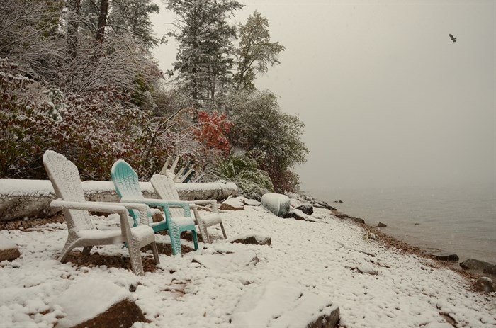
Early season snowfall can be seen in Vernon on the shore of Okanagan Lake, Friday, Oct. 23, 2020.
(BEN BULMER / iNFOnews.ca)
The snow isn’t expected to end until this evening and will be followed by a blast of Arctic air, so don’t expect the snow to be gone by election day tomorrow, Lundquist says.
A snowfall warning is in effect for the South Thompson with 10 to 15 cm of snow expected in Kamloops. Up to 10 cm could accumulate on valley bottoms, with snow expected to continue for most of the day.
Kamloops RCMP are warning drivers to slow down and drive to the weather conditions following several car crashes this morning. Police suggest if you don't have to drive today, don't, or at the very least, wait until the snowplows have had a chance to clear and sand road.
A snowfall warning is also in effect for the Central Okanagan and South Okanagan, including Kelowna and Penticton, with up to 10 cm expected on the valley bottom, and accumulations of up to 15 cm at higher elevations.
No snowfall warning has been issued for Vernon, but the city could see between five and 10 cm of snow through today before ending around midnight tonight.
The snow is expected to taper off later today, to be replaced by a drying trend on Saturday that will see Arctic air spread through the B.C. Interior.
Kamloops and the Okanagan should see mostly sunny conditions return on Saturday and Sunday, but daily highs will struggle to get above 0 Celsius.
A warming trend is expected to start Monday with temperatures back to seasonal values by Wednesday.
Driving on the upper elevation highways highways today is not recommended.
Weather alerts have been issued for highways in and out of the Thompson and Okanagan today.
Snowfall warnings are in effect for the Coquihalla Highway, Hope to Merritt and Merritt to Kamloops, Highway 3 via Allison Pass, and the Okanagan Connector from Merritt to Kelowna.
Between 15 and 20 cm of snow is expected by the end of the day on parts of the Coquihalla Highway, the Okanagan Connector and on Highway 3 between Hope and Princeton.
Drive BC is reporting a vehicle incident on Highway 5 this morning between Exit 183, Peers Creek Road and Exit 290. Commercial vehicles have also spun out on Larson Hill and the road is currently closed.
A travel advisory is in effect for Highway 5 in both directions as well as on Highway 97C.
If you are planning to drive to Alberta, be aware a special weather statement has been issued by Environment Canada for the Trans-Canada Highway from Rogers Pass to Eagle Pass warning of heavy snow.
Motorists should check the Drive BC website prior to travel.
— This story was updated at 2:35 p.m. Friday, Oct. 23, 2020 to include more information from Environment Canada.
To contact a reporter for this story, email Steve Arstad or call 250-488-3065 or email the editor. You can also submit photos, videos or news tips to tips@infonews.ca and be entered to win a monthly prize draw.
We welcome your comments and opinions on our stories but play nice. We won't censor or delete comments unless they contain off-topic statements or links, unnecessary vulgarity, false facts, spam or obviously fake profiles. If you have any concerns about what you see in comments, email the editor in the link above.
News from © iNFOnews, 2020