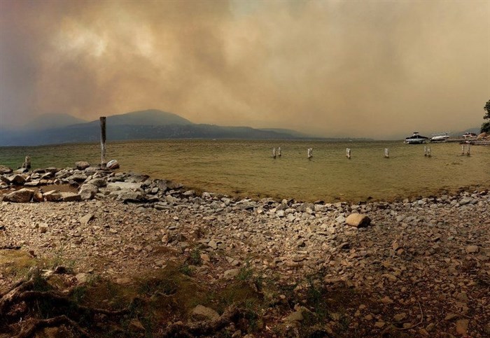
Looking north from Hurlburt Park over Okanagan Lake towards Whiteman Creek area, where the White Rock Lake wildfire burned through parts of Okanagan Indian Band IR #1 on Aug. 15, 2021.
Image Credit: Kelsie Kilawna, Local Journalism Initiative
August 21, 2021 - 11:43 AM
A 80,745.0 hectare wildfire burning along Westside Road in the Central Okanagan is seeing increased fire behaviour on its northeast flank, east flank, and southeast flank.
"Suppression activities continues on all flanks of the fire with a focus along Westside Road where the wildfire has impacted communities. Precipitation received throughout the morning today has helped to lessen fire activity, however not all areas of the fire have received precipitation. The decrease in estimated size is a result of more accurate mapping along the northern flank of the fire," according to the B.C. Wildfire Service's latest update, Aug. 21.
Today on the east flank of the fire, crews and equipment will continue to defend containment lines above communities and protect structures. With the Okanagan's current drought, there is incredibly deep burning forest fuels making it difficult to fully extinguish the fire in this area, according to the wildfire service.
On the fire's northeast flank, south of Glenemma, crews continued with routine hand ignitions to secure the edge of the containment line, south of Irish Creek Road/west of Westside Road.
On it's northern flank, crews continue to patrol and perform mop up tasks from Adelphi Forest Service Road to Woods Lake, Grange Forest Service Road west to Douglas Road, from Biancotto Lake north to Paxton Lake, and north to Highway 97 continues.
The west and south flanks of the fire continue to be observed by aerial resources, according to the wildfire service.
For more information on evacuation orders and alerts visit the Columbia-Shuswap Regional District, Regional District of North Okanagan, Thompson Nicola Regional District, Splatsin, Okanagan Indian Band, Regional District of Central Okanagan, City of Vernon or the Township of Spallumcheen's website.
To contact a reporter for this story, email Carli Berry or call 250-864-7494 or email the editor. You can also submit photos, videos or news tips to the newsroom and be entered to win a monthly prize draw.
We welcome your comments and opinions on our stories but play nice. We won't censor or delete comments unless they contain off-topic statements or links, unnecessary vulgarity, false facts, spam or obviously fake profiles. If you have any concerns about what you see in comments, email the editor in the link above.
News from © iNFOnews, 2021